1

When using the Intersect tool in ArcGIS (Desktop 10.8): I have two inputs, a polyline FC and a polygon FC. I want to get the intersection of each polyline feature with the polygon features, so the polylines resulting will be split where they cross polygon boundaries and will have attributes assigned from the polygons accordingly. But, the tool also intersects the polylines with each other. This produces unwanted results. Is there a way to avoid the self-intersection in this process? Or is that just how the tool works and I have to deal with it? I guess there are ways to clean up self-intersection results after the fact, but I would ideally like to prevent it from happening in the first place.

To clarify...I'm not talking about the kind of intersection where one line crosses another. I'm talking about intersecting geometry as defined by the "Intersect" processing tool...which really might be better called "overlapping" geometry - where part of one line overlaps/shares the same geometry as part of another line in the same feature class. Where this happens, the tool splits out that overlapping part as a separate line feature in the result. But I wish the tool would not do this. I wish it would essentially consider each line feature independently of every other line feature in the same FC and only intersect it with the overlaying polygons. I want to maintain the existing geometry of each line, except they should be split only where they cross polygon boundaries and inherit the attributes of the respective polygons.

0

3 Answers 3

1

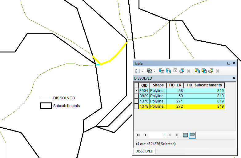
Dissolve result of intersection: enter image description here by two fields: enter image description here

UPDATE: This is to address @alexGIS concern.

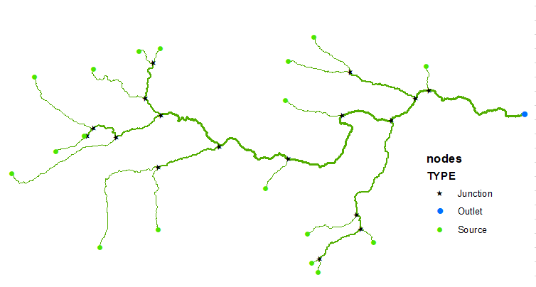
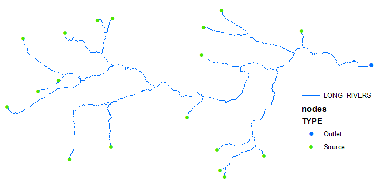
Stream network: enter image description here replaced by 'long rivers' running from source to outlet: enter image description here

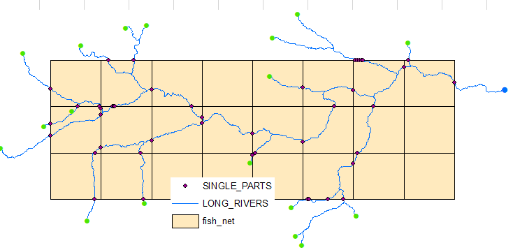
Intersects (a) points! and b)exploded to single parts!) with polygons: enter image description here

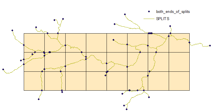
Delete identical points and Split Line by Points. Picture shows both ends of sliced lines:

enter image description here

18 segments are selected, because there are 18 source nodes in network (and 18 long rivers).

enter image description here

4
  • I'm using ArcMap 10.8.2 Intersect tool and I'm not getting those results. The output ONLY has the line segments that are overlaid with the polygon(s). All other line segments are excluded from the output, including the lines that overlap each other. That being said, have you tried Spatial Joins?
    – alexGIS
    Commented Apr 13, 2023 at 15:41
  • @FelixIP This is a good way to clean up after the fact, and it is still the best workflow I have found for this scenario, but not the ideal solution I was hoping to find. Perhaps this is the best we can do? Commented Apr 17, 2023 at 20:31
  • @alexGIS I have tried Spatial Join. It does not split the lines where they intersect polygon boundaries as needed. Commented Apr 17, 2023 at 20:33
  • Procedure is simple. Create copy of tour lines and truncate it's table. Select first line, intersect (to in_memory fc) it with polygons, append result to initially empty feature class. Repeat for next line. Simple script or even model,
    – FelixIP
    Commented Apr 18, 2023 at 0:38
0

You should use the Identity tool. It allows you to assign attributes from the polygons to the roads that overlap them. The lines do not interact with each other in the analysis. You get all the roads outputted, including the roads that had no polygons overlap them, not just the ones that were overlapped by the polygons.

3
  • Well hot damn that sounds like what I need. I’ve seen that tool but I never knew what exactly it did. I’m gonna give it a try. Commented Apr 15, 2023 at 3:01
  • Well, I tried Identity, with the polyline FC as input features and polygon FC as identity features. I found it behaves the same way as Intersect - it adds vertices and splits out portions of lines where they intersect (overlap) each other, not just where they intersect polygon boundaries in the other FC. So no better unfortunately. Commented Apr 17, 2023 at 20:26
  • You're correct, my bad. If you did use Identity though, you could use the outputs to generate the desired result with additional steps. Doesn't look like there is a tool that does exactly what you need in one step. It would be nice to have the option to have features in the same layer ignore each other.
    – alexGIS
    Commented Apr 19, 2023 at 17:57
0

As suggested by user lookasism on reddit: the Pairwise Intersect tool in ArcGIS Pro does exactly what I was looking for. I had been meaning to start using Pro more, just have been stubborn about it, but this is the thing that has finally gotten me there.

To accomplish the same thing without Pro, they recommended this tool which also worked: https://www.arcgis.com/home/item.html?id=120807ac7f8449f89840ae48e87d7f55

Helpful info here: https://www.esri.com/arcgis-blog/products/arcgis-desktop/analytics/are-you-sure-intersect-is-the-right-tool-for-the-job/

Your Answer

By clicking “Post Your Answer”, you agree to our terms of service and acknowledge you have read our privacy policy.

Not the answer you're looking for? Browse other questions tagged or ask your own question.