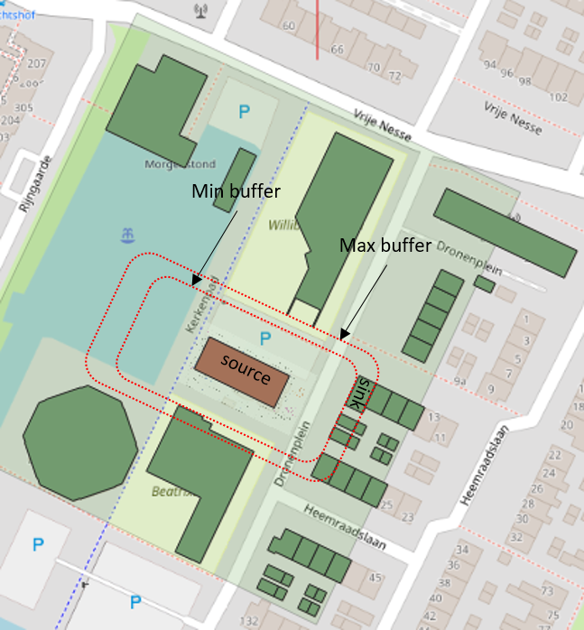
I'm working with buildings in QGIS (vector polygons) and have two layers - call them a "source" building and multiple "sink" buildings (in second layer). How would I go about finding the minimum and maximum buffer from the "source" building required to "cover" the sink "buildings"?
Put in another way if I keep extending the buffer outwards of the "source" building, how can I get the difference between where this buffer first intersects a "sink" building and last intersects it?

