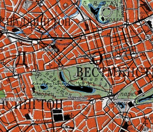
In your browser, mouse-over a map and use "open image" or "open image in new tab" (or similar, depending on browser) to see a tile.
This gets you something like:
https://y.tile.bbbike.org/cgi-bin/tapp/tilecache.py/1.0.0/topomapper_v2/11/1099/671.jpg
The last three parts are the zoom, x, and y coordinate reference of the tile.
In QGIS Browser panel, right-click on "XYZ Tiles" and create a new connection, with the URL like the above but replacing the numbers with the {x}{y}{z} template markers. The small number here (11) is the "z" (zoom) but it only takes two tries to get the X and Y the right way round.
https://y.tile.bbbike.org/cgi-bin/tapp/tilecache.py/1.0.0/topomapper_v2/{z}/{x}/{y}.jpg
Give it a name, OK it, then it should appear in the list under the XYZ Tiles list. Double-click...and.. here it is with Stamen Toner overlaid multiplicatively (black lines) so you can compare:

BUT and this is a ginormous BUT make sure the terms and conditions of the site and the map allow you to do this otherwise the hosts might block you.
If viewing an image doesn't help, use your browser's "Inspect" or "Debug" facility to look at a network transfer of a tile.
Also you could probably dig into their Javascript and get all the layer URLs in some way. Indeed, all the layer descriptions start about line 1500 of https://mc.bbbike.org/mc/js/mc.js?version=1648972995

