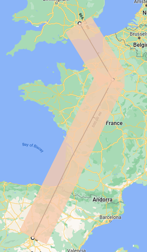
I have searched high and low and cannot figure out how to do this... I need to create a polygon based off a flight path, defined by radius to either side of the path. For example, if an airplane flies from Madrid, to Paris, then to London, I'll have a line with three points. I need to create a polygon around that line, extending out from either side of the line by a specified radius. Example: given the black line between the three cities, my polygon would be roughly what's shown in orange. Any suggestions on how I approach this? My end goal will be to find whether specific points exist within the polygon (which I know how to do).
-
1Modeling for flight path often includes slip space for course correction after turn (outside the turn, for a nautical miles or two). If you can construct the parallel lines (as great circle routes), constructing a polygon is just saving the vertices as a list and a stack, then appending the popped stack to the list.– VinceCommented Aug 15, 2022 at 21:33
-
2Using what software?– SpacedmanCommented Aug 15, 2022 at 21:48
-
I am not using a specific software app. Looking more for the algorithms. This logic is going into a custom application.– SteveCommented Aug 16, 2022 at 15:16
Add a comment
|
1 Answer
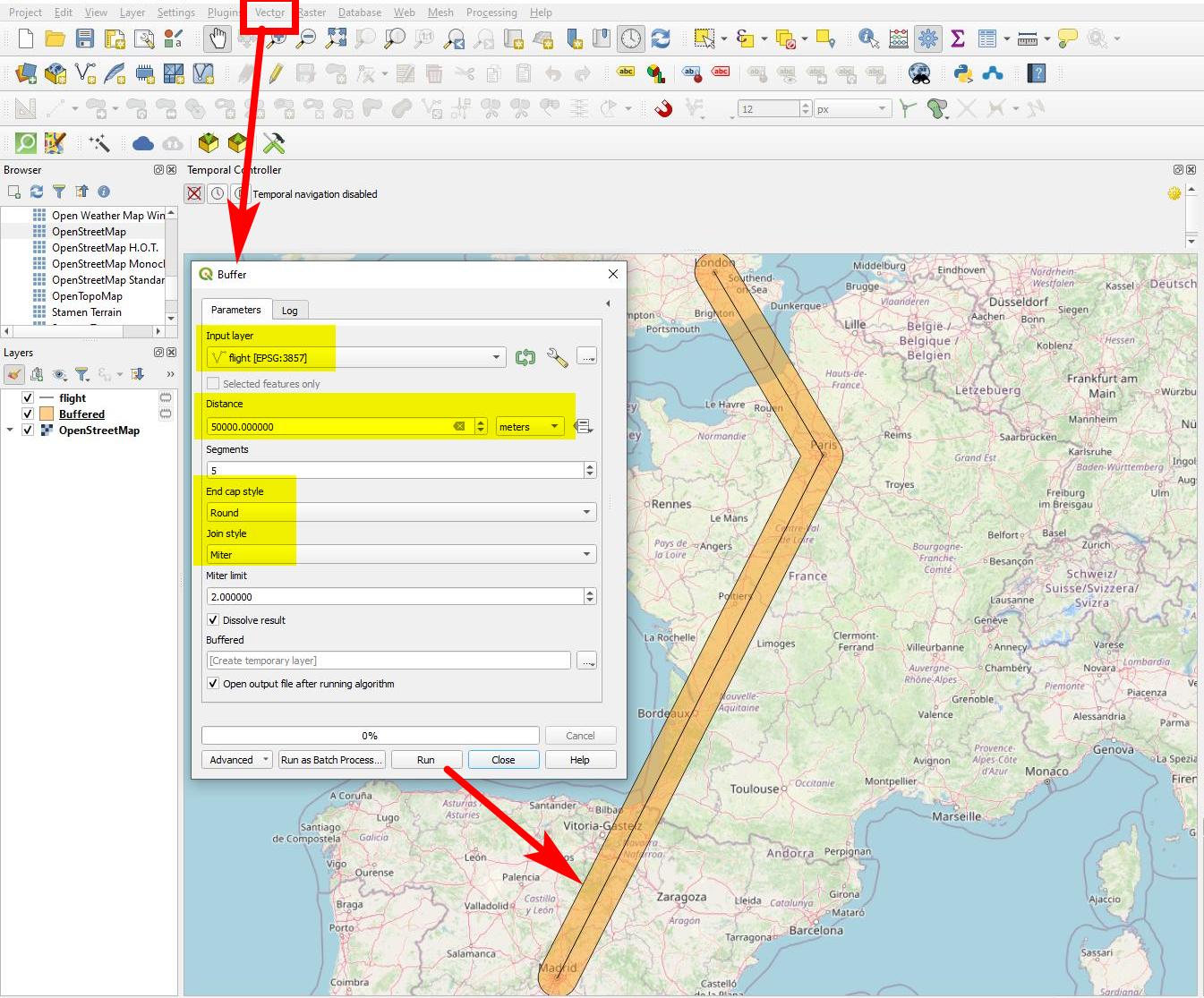
Create a buffer around your line. Use Menu Vector > Geoprocessing Tools > Buffer (see screenshot below).
Be aware that you use a proper CRS - one that is appropriate to measure distances. UTM zone 30 N / EPSG:32630 might be a start, a custom CRS based on that even better.


