Oops, seems that my question is "a XY Problem"... More precisely two confusions:
1- Conceptual confusion:
2- Confusion about SRID descriptions:
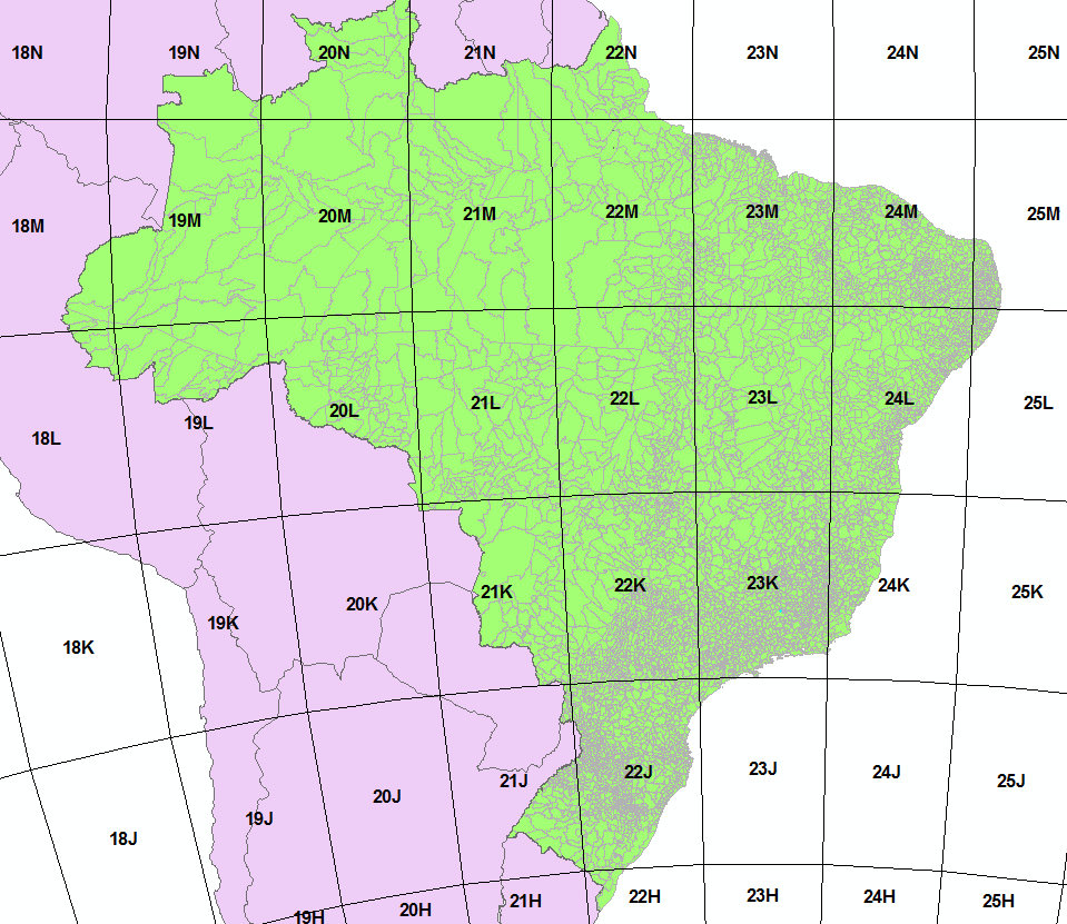
Y2 Problem: "UTM zone 18N" is the quadrant 18N of the set {..., 18L, 18M, 18N, ...}, that is, the Zone 18 Latitude bands. A wrong hypothesis.
X2 Problem: "UTM zone 18N" is the "zone 18 at Northern hemisphere", and "UTM zone 18S" the Southern.
Note. As explained in the question-body, a possible source of confusion is the EPSG standard, with many SRID variations, some non-complete sets of UTM variations.
The "official SRID" for UTM Grid and UTM zones
Official, and easy rule-of-the-thumb.
Prefer the SRID with the title "WGS 84 / UTM zone {x}{h}",
where h=Hemisphere, Southern or Northern:
- when h=
S use SRID number326{x}
- when h=
N use SRID number327{x}
For example for Zone 22S use x=22 and h=S, so SRID=32622.
To automatize by latitude check, use h=S when ST_Y(geom)>0, see a utmzone() function here.
Grid geocode-prefixes are all based on UTM zone number, and suffixe-letters are the Latitude bands: the letter "N" is the first letter in "northern hemisphere" — so letters "A" to "M" are southern hemisphere, "N" to "X" northern.
Official SIRGAS 2000 for Brazil
SELECT srid,  substr(srtext,9,26) as title, left(proj4text,26)||'...' as proj4text
FROM  spatial_ref_sys
WHERE srtext ilike '%SIRGAS%2000%UTM%zone%' AND srtext~'(18|19|20|21|22|23|24|25)S'
ORDER BY 3;
| srid |
title |
proj4text |
| 31978 |
SIRGAS 2000 / UTM zone 18S |
+proj=utm +zone=18 +south ... |
| 31979 |
SIRGAS 2000 / UTM zone 19S |
+proj=utm +zone=19 +south ... |
| 31980 |
SIRGAS 2000 / UTM zone 20S |
+proj=utm +zone=20 +south ... |
| 31981 |
SIRGAS 2000 / UTM zone 21S |
+proj=utm +zone=21 +south ... |
| 31982 |
SIRGAS 2000 / UTM zone 22S |
+proj=utm +zone=22 +south ... |
| 31983 |
SIRGAS 2000 / UTM zone 23S |
+proj=utm +zone=23 +south ... |
| 31984 |
SIRGAS 2000 / UTM zone 24S |
+proj=utm +zone=24 +south ... |
| 31985 |
SIRGAS 2000 / UTM zone 25S |
+proj=utm +zone=25 +south ... |
WGS84_UTMzone as alternative SRID for SIRGAS2000
SIRGAS is not world-wide, is only a South American Datum, characterized by its network of ~200 stations

Therefore it has non-complete UTM Zones set at ESPG standard... But is possible to confirm that SIRGAS 2000 is de jure and de facto, since ~2015, WGS 84.
It is easy to check by implementation, using the SQL query select srid, substr(srtext,9,26)||' ...' srtext_fragment, proj4text from spatial_ref_sys where srid in (6210,32623,4326):
| SRID |
srtext_fragment |
proj4text |
| 4326 |
WGS 84 |
+proj=longlat +datum=WGS84 |
| 6210 |
SIRGAS 2000/ UTMzone 23N |
+proj=utm +zone=23 +ellps=GRS80 +towgs84=0,0,0,0,0,0,0 +units=m |
| 32623 |
WGS 84/ UTMzone 23N |
+proj=utm +zone=23 +datum=WGS84 +units=m |
The old ellps=GRS80 has minimal difference (millimettric according to Wikipedia) and only impact on high precision altitude measures. On surface measurements the WGS 84 is a synonymous, as showed by towgs84=0,0,0,0,0,0,0 parameter.
SRID equivalence:
| SIRGAS SRID |
UTM zone |
WGS 84 SRID |
| 31978 |
18S |
32618 |
| 31979 |
19S |
32619 |
| 31980 |
20S |
32620 |
| 31981 |
21S |
32621 |
| 31982 |
22S |
32622 |
| 31983 |
23S |
32623 |
| 31984 |
24S |
32624 |
| 31985 |
25S |
32625 |


