3

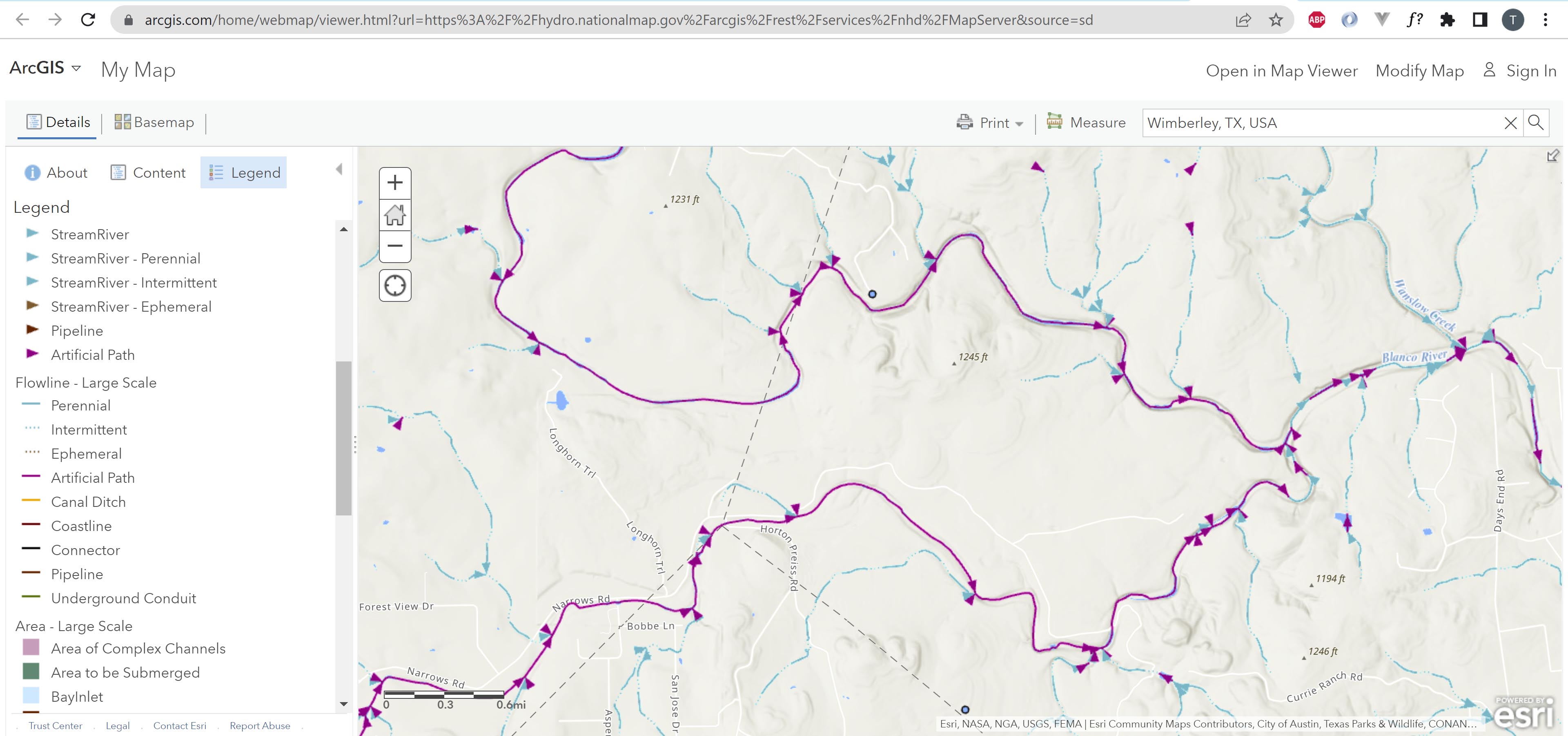
According to the National Hydrography Dataset, the Blanco River in Texas consists of 108.3km of "artificial paths", 36.677km of it is a perennial river and 2.297km of it is an intermittent river. Here's a screenshot from https://www.arcgis.com/home/webmap/viewer.html?url=https%3A%2F%2Fhydro.nationalmap.gov%2Farcgis%2Frest%2Fservices%2Fnhd%2FMapServer&source=sd that depicts this:

enter image description here

Purple is "Artificial Path".

The thing is... that is definitely not accurate. Like there's a stretch of it that flows through a gorge. A non-made made gorge. There's a book on the river, which talks about it's geology and it's history (including it's discovery by Spanish explorers in the 1700's). That book makes no mention it being an artificial path, which seems like a pretty remarkable fact given that, per the NHD, >73% of it, per the NHD, is an "artificial path".

My question is... is the NHD often wrong? Why would it be wrong? And is there any mechanism to correct it?

The NRHP GIS data set gives the following disclaimer:

Some of the resources, especially complex historic districts, may look odd. The map is based on the information in our records. Our guidance and records were not designed for modern applications. We are working on creating a better system, and updating our information, but this is the information we have now.

Maybe there's a similar sort of disclaimer on the NHD's website?

3
  • 1
    Accuracy varies: usgs.gov/faqs/… (40ft-167ft) "designed to be used in general mapping and in the analysis of surface water systems" connect to the team usgs.gov/national-hydrography/connect
    – Mapperz
    Commented Oct 4, 2022 at 12:59
  • 1
    There is a newer product called NHDPlus HR usgs.gov/national-hydrography/nhdplus-high-resolution currently in progress.
    – Mapperz
    Commented Oct 4, 2022 at 13:03
  • 2
    I actually worked for a company that was editing the NHDPlus network. This is done by a team of entry-level gis technicians. It's mind numbing, repetitive, endless work. It's reviewed by people doing slightly less mind numbing and repetitive work. So it is inherently flawed because it's hard to care about that kind of work, IMO. This is like the dishwashing of the GIS world. Imagine sitting at a desk drawing lines on top of satellite imagery all day, every day.
    – jbalk
    Commented Oct 4, 2022 at 17:26

1 Answer 1

1

Looking at your screenshot I would say the data is cartographic in origin, not a product of say a DEM, which tend to have rivers that are more angular, well that's my experience for what it counts. So the data has come from people manually digitizing it and there in lies the problem, people, not known for being consistent and very error prone so I would have as a guess that in some distant past this was transcribed from some data source and incorrectly labelled. These errors persist for years in large organisations as they generally can't afford to quality control their own datasets unless its mission critical? I would explore this NHDPlus HR as suggested by @Mapperz otherwise you'll need to manually update it yourself. If you did do the manual update maybe you could fire the list of ID's back to them and say what you did, might encourage a more rapid review of the data?

Your Answer

By clicking “Post Your Answer”, you agree to our terms of service and acknowledge you have read our privacy policy.

Not the answer you're looking for? Browse other questions tagged or ask your own question.