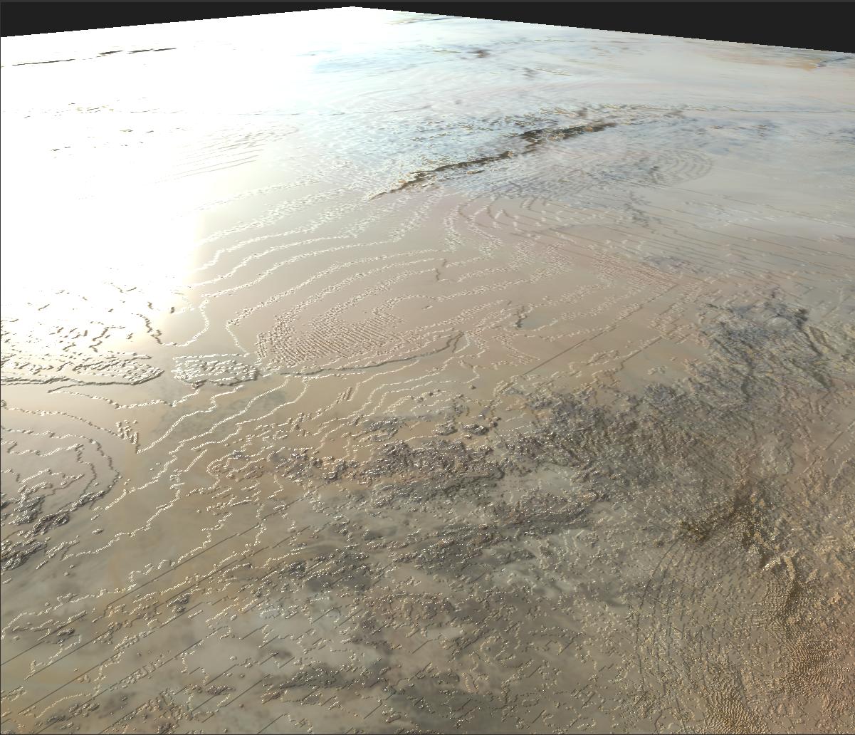
I'm a 3D artist working on a procedural planet generator, based on colour and height textures from real-life areas. I've been using the GeoTIFF files from NASA Visible Earth, but they all seem to be in 8 bit format which causes bad stepping artifacts when they're used as height maps.
Is there anywhere I can find global 16 bit height rasters, or is it possible for me to increase the bit depth of the ones from NASA Visible Earth?
Or are there any non-raster elevation datasets that I can convert into 16 bit rasters with QGIS? I suspect this would be the best method, but I don't know QGIS very well, so I have no idea how.

