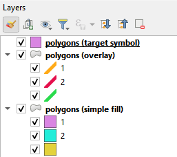
I have encountered a categorised polygon file representing geological units (hundreds of unique categories). The polygon file contains two fields, one for controlling a simple fill colour, the other for controlling an overlying textural pattern. There are symbol sets for each.
The intended cartographic representation of this in a project is to have the same data as duplicated layers, with the simple fill below the textured layer and thus a combined appearance is the intended output on a published map.
While this works in terms of a map output it creates a couple of issues including the problem of creating a legend showing the combined symbology for each geological category.
An obvious solution is to combine the two component symbologies into a new symbol set. However, this would be a big task to do manually as I am not aware of a tool to simply merge symbols. Does anyone know of a simple solution for this problem?


