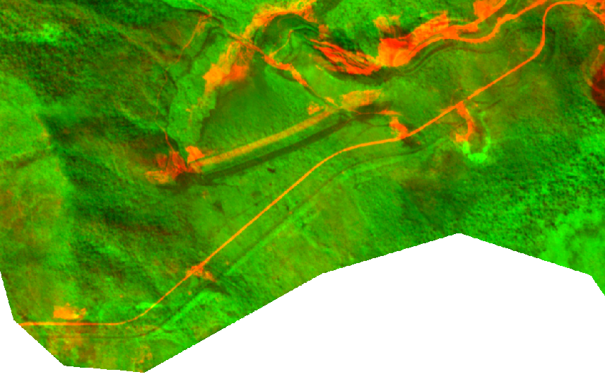
I recently got some 4band images from Planet. When I attempted to calculate NDVI, the results seemed off. Once i got to looking at the bands, I found that the NIR band and the visible light bands were misaligned. I purchased the PSScene images from their analytic_udm2 bundle. Bundle descriptions here. As far as I can tell, these were meant to be orthorectified. However, when I compare red to NIR, I find that they are misaligned. They are off by about 100 meters. These are 2 bands in a single raster block.
In this image, red is shown as red and NIR is shown as green.
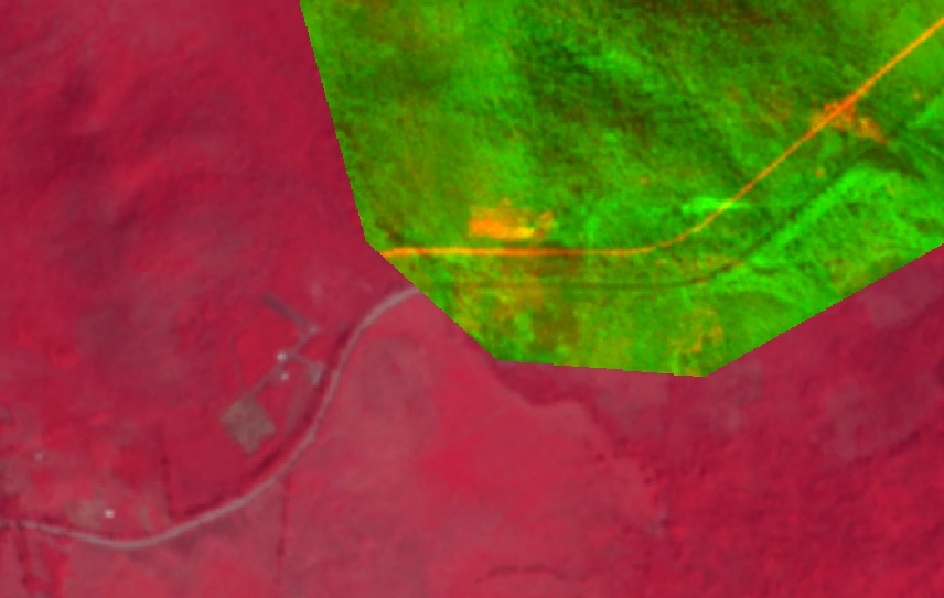
When comparing the raster to their publically available NICFI basemaps, I find that only the NIR band aligns with their analytic basemap.
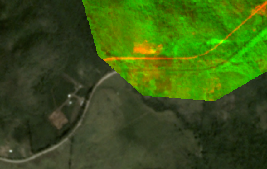
Also with their visual basemap: NIR aligns, the visual bands do not:
¿Is there a way to fix this so I can get my NDVI calculations?
I apologize if I am missing something obvious, I am relatively new to this.
All images shown as examples are not analyzed at all but directly put into qgis from download and visualized using multiband color.


