0

I downloaded a .shp file from NOAAs website for the shoreline . [https://nsde.ngs.noaa.gov].

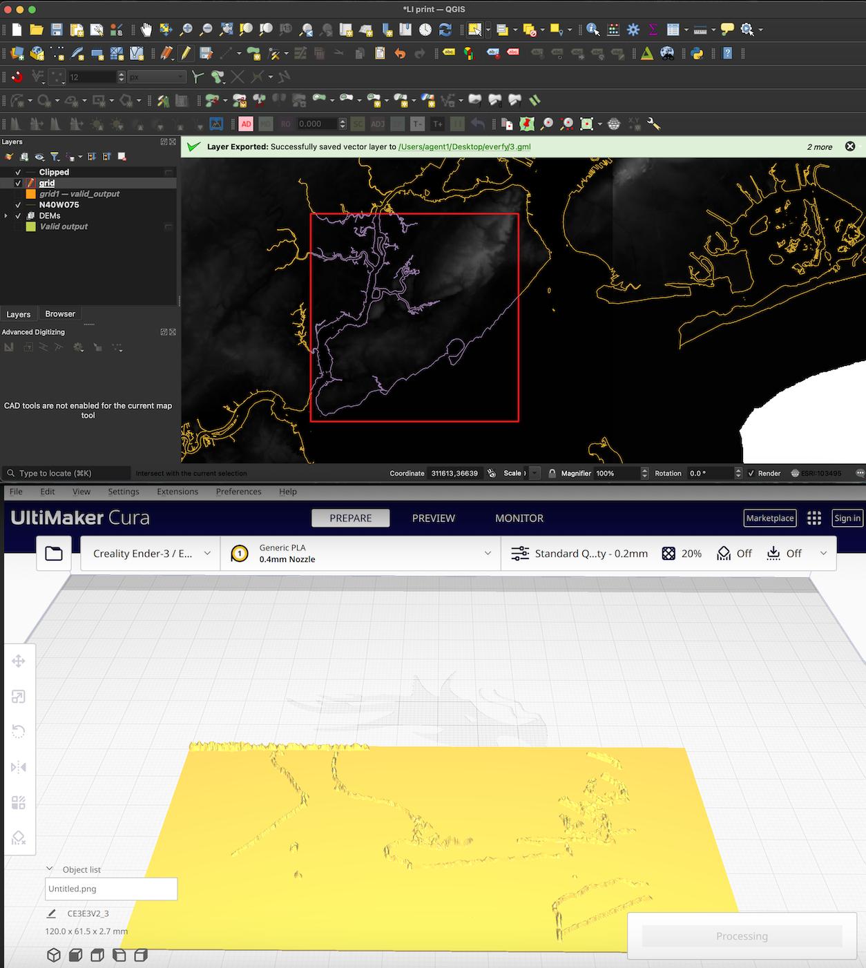
I am trying to 3d print from Cura the shoreline file to add to my dem file 3d print of topography so I can accurately show the shoreline.

its seems the only way so far to do so after exporting the .shp from QGIS into a .dxf is to use a third party app to convert .dxf to .png and bring it in CURA. This does not print the shoreline flat and to scale?!

HELP!!!!!!!!

How do I add my vector line to my 3d printed modelenter image description here

2
  • what does it even mean to add a vector line file as input to Cura? What do you want it to do with it? Presumably the sea past the coastline in your DEM is just flat. But if you really are concerned about shoreline modeling, import the the DEM and the shoreline shapefile into a GIS program like QGIS,then mask the DEM to the land area and export the resulting clipped DEM file as something CURA will read.
    – Llaves
    Commented May 7, 2023 at 23:08
  • Please clarify your specific problem or provide additional details to highlight exactly what you need. As it's currently written, it's hard to tell exactly what you're asking.
    – Community Bot
    Commented May 8, 2023 at 0:08

0

Your Answer

By clicking “Post Your Answer”, you agree to our terms of service and acknowledge you have read our privacy policy.

Browse other questions tagged or ask your own question.