3

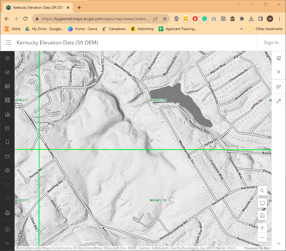
I am creating a map for the nature preserve I work at. I have been downloading Kentucky elevation data from THIS website. You can see that there is a really high resolution, and I am able to see the geologic features in great detail on the website. Kentucky Elevation Data Website Screenshot
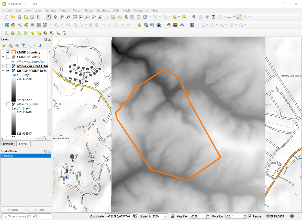
The nature preserve falls into the two tiles N065E238 and N066E238. When I upload the TIF file from the Kentucky Elevation Data tiles by dragging the file into QGIS, it looks blurry/has less resolution. Screenshot of QGIS with bad resolution of data
I've played around a bit with QGIS and have not found a solution.

0

1 Answer 1

13

You have downloaded a digital elevation model (DEM). The top screenshot is showing a hillshade.

You can either style the DEM as a hillshade or create a hillshade.

Style F7:

enter image description here

The same layer with Hillshade styling:

enter image description here

If you want a persistent hillshade that you can save to file use some of the processing tools Ctrl+Alt+T to create it:

enter image description here

Your Answer

By clicking “Post Your Answer”, you agree to our terms of service and acknowledge you have read our privacy policy.

Not the answer you're looking for? Browse other questions tagged or ask your own question.