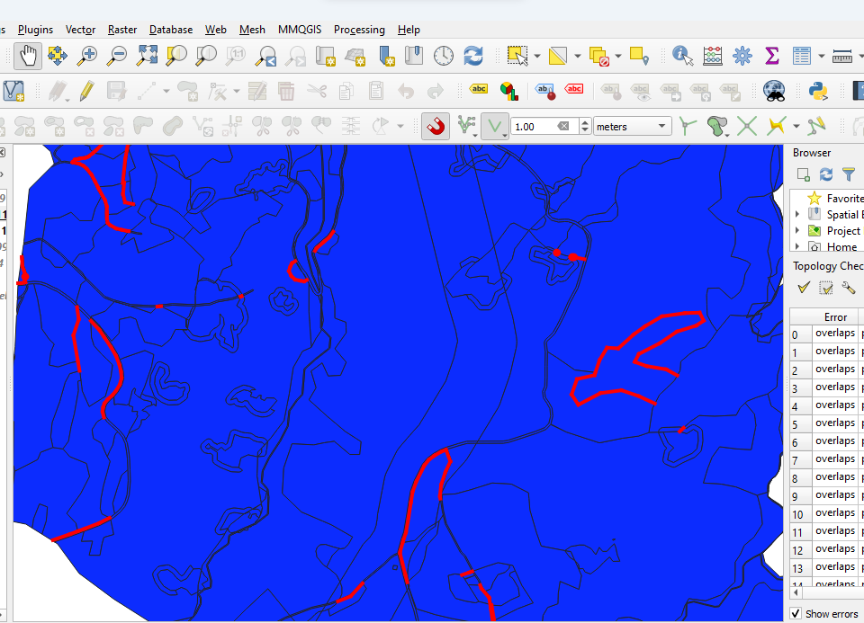
After using the Union tool on QGIS I get hundreds of gaps and overlaps between polygons on the resulting shapefile.
If I zoom to the fullest on those gaps and overlaps they are always lines, they never show any area.
Sometimes the error disappears after I move the vertices associated with the gaps, but it doesn't always happen and there being hundreds of errors it would take a lot of time.
Is there any solution for not getting this kind of error, or any way I can fix my shapefile?
.
-
2You could try a small buffer before unioning– Ian TurtonCommented Nov 4, 2023 at 16:41
-
Maybe a valid answer?– BabelCommented Nov 4, 2023 at 16:42
-
You can also try snap to grid before and/or after the union– BeraCommented Nov 4, 2023 at 19:55
-
Just tried snap to grid and got more errors than before. I left the 1 meter grid spacing that comes default, are there better values? Thank you– Gonçalo CoimbraCommented Nov 4, 2023 at 20:18
-
What type of layers are you using, shapefiles, file geodatabases. geopackages, etc.? If a file geodatabase does an input have true curves and what is its validated tolerance? I would check my inputs geometry and run a v.clean with a suitable tolerance followed by remove duplicates on each layer, then try the union.– JohnCommented Nov 4, 2023 at 22:43
|
Show 1 more comment
