I have a bunch of raster maps from a general plan of a city.
Examples:
- Areas reserved for federal, regional and municipal buildings
- Special land use zones
- Zoning
- Risks of occurrence of emergencies
- Power supply scheme
- Industry, energy sector and tranportation zones
- Transportation infrastructure scheme
- Water supply and sewage scheme
I need to vectorize them such that I can store all elements (lines, polygons, points) of the map listed in the legend in a database like PostGIS such that I can
- find all elements of a master plan, which affect a certain region on the map (e. g. if I have a house at location X and the government wants to build a road in the same place, I want to notice it) and
- compare two versions of a master plan by running database queries.
The ultimate purpose is to bring the data contained in these maps into a format that can be understood by non-technical people - inhabitants of the city so that they can express agreement or disagreement with the general plan.
One obvious approach is to simply lay raster map over a vector map of the region (there is a vector map of that city in OSM) and manually transfer the lines from raster to vector form.
- What tools (preferably open source) can I use to vectorize the maps manually and save the data in PostGIS?
- Are there any alternatives, which are faster? Can this process be automated (fully or partially) using open source or inexpensive commercial software?
Update 18.01.2013: FYI: I asked the copyright holder (city administration) of the maps to provide them in vector format. I'll wait for their answer and then decide on further actions.
Update 27.01.2013:
Today I made a first experiment in georeferencing for these maps.
Inputs:
Process: You can see how I do georeferencing in this video.
Results:
- GCP points for both maps
- Modified raster map
I have following questions:
- How many points do I need to enter in order to have good enough quality of the mapping? Are there any rules of thumb for that?
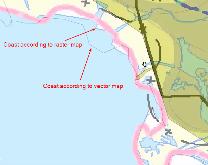
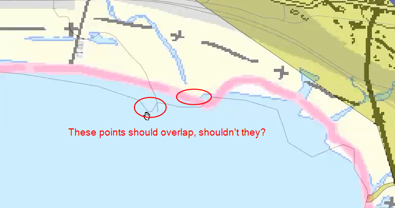
- What can I do to improve the quality of the mapping (remove mapping defects shown below) ?
Sample mapping defect #1

Sample mapping defect #2

