I would like to convert a GML file with cadastral parcels to GeoJSON format using ogr2ogr. See also attached extract of the GML file at the end of this question.
Additional requirements:
- Convert projection from EPSG:28992 to EPSG:4326
- Limit precision in the output file to 7 decimals
- Convert all features, but only selected attributes from each feature
The command:
ogr2ogr -lco COORDINATE_PRECISION=7 -f "GeoJSON" cadastral_parcels.geojson -t_srs "EPSG:4326" cadastral_parcels.gml
gives the required conversion with the right projection, although it takes two runs. The first time executed, ogr2ogr generates a gfs file (see attached file). In this file I have to change line 6:
<GeometryType>1</GeometryType>
for:
<GeometryElementPath>begrenzingPerceel</GeometryElementPath>
I have no clear idea why this is needed, but it is the same change required when importing the GML file in QGIS to make QGIS show the polygons of each parcel instead of single points. Executing the ogr2ogr command after this change results in effective conversion to GeoJSON format, changed projection from the original EPSG:28992 to EPSG:4326 and limited precision to 7 decimals.
The issue I am left with is to select only particular attributes. The resulting GeoJSON file holds besides the Polygon coordinates in <oz:begrenzingPerceel> .... </oz:begrenzingPerceel> also all additional attributes from the original GML file.
I am only interested in the attributes:
<oz:perceelnummer>2298</oz:perceelnummer>
and
<oz:perceelnummerRotatie>0.0</oz:perceelnummerRotatie>
Is there an option for ogr2ogr to select which attributes should be included in the output file and which not?
Or is there another command line tool to remove the unwanted attributes from my resulting GeoJSON file?
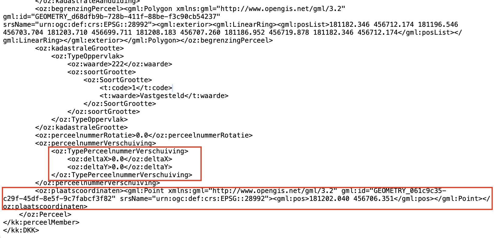
Extract GML file:
<?xml version="1.0" encoding="UTF-8"?>
<kk:DKK
        xmlns:xsi="http://www.w3.org/2001/XMLSchema-instance"
        xmlns:gml="http://www.opengis.net/gml/3.2"
        xmlns:oz="http://www.kadaster.nl/schemas/brkkadastralekaart/v5/imkad-onroerendezaak/v20220601"
        xmlns:h="http://www.kadaster.nl/schemas/brkkadastralekaart/v5/imkad-historie/v20220601"
        xmlns:t="http://www.kadaster.nl/schemas/brkkadastralekaart/v5/imkad-typen/v20220601"
        xmlns:ko="http://www.kadaster.nl/schemas/brkkadastralekaart/v5/imkad-kadastraalobject/v20220601"
        xmlns:q="http://www.kadaster.nl/schemas/brkkadastralekaart/v5/imkad-kwaliteit/v20220601"
        xmlns:kk="http://www.kadaster.nl/schemas/brkkadastralekaart/v5/stand/v20220601"
        xsi:schemaLocation="http://www.kadaster.nl/schemas/brkkadastralekaart/v5/stand/v20220601 http://www.kadaster.nl/schemas/brkkadastralekaart/v5/xsd/dkk/stand/v20220601/DKK-Product_Stand_v5_0_0.xsd">
<kk:perceelMember>
    <oz:Perceel gml:id="NL.IMKAD.KadastraalObject.84920229870000">
        <ko:identificatie domein="NL.IMKAD.KadastraalObject">84920229870000</ko:identificatie>
        <oz:historie>
            <h:beginGeldigheid>2000-11-20T14:29:09+01:00</h:beginGeldigheid>
            <h:tijdstipRegistratie>2000-11-20T14:29:09+01:00</h:tijdstipRegistratie>
            <h:volgnummer>0</h:volgnummer>
            <h:statusHistorie>
                <h:StatusHistorie>
                    <t:code>G</t:code>
                    <t:waarde>Geldig</t:waarde>
                </h:StatusHistorie>
            </h:statusHistorie>
        </oz:historie>
        <oz:kadastraleAanduiding>
            <oz:TypeKadastraleAanduiding>
                <oz:kadastraleGemeente>
                    <oz:KadastraleGemeente>
                        <t:code>761</t:code>
                        <t:waarde>Otterlo</t:waarde>
                    </oz:KadastraleGemeente>
                </oz:kadastraleGemeente>
                <oz:sectie>B</oz:sectie>
                <oz:perceelnummer>2298</oz:perceelnummer>
                <oz:aKRKadastraleGemeenteCode>
                    <oz:AKRKadastraleGemeenteCode>
                        <t:code>812</t:code>
                        <t:waarde>OTL02</t:waarde>
                    </oz:AKRKadastraleGemeenteCode>
                </oz:aKRKadastraleGemeenteCode>
            </oz:TypeKadastraleAanduiding>
        </oz:kadastraleAanduiding>
        <oz:begrenzingPerceel><gml:Polygon xmlns:gml="http://www.opengis.net/gml/3.2" gml:id="GEOMETRY_d68dfb9b-728b-411f-88be-f3c90cb54237" srsName="urn:ogc:def:crs:EPSG::28992"><gml:exterior><gml:LinearRing><gml:posList>181182.346 456712.174 181196.546 456703.704 181203.710 456699.711 181208.183 456707.260 181186.952 456719.878 181182.346 456712.174</gml:posList></gml:LinearRing></gml:exterior></gml:Polygon></oz:begrenzingPerceel>
        <oz:kadastraleGrootte>
            <oz:TypeOppervlak>
                <oz:waarde>222</oz:waarde>
                <oz:soortGrootte>
                    <oz:SoortGrootte>
                        <t:code>1</t:code>
                        <t:waarde>Vastgesteld</t:waarde>
                    </oz:SoortGrootte>
                </oz:soortGrootte>
            </oz:TypeOppervlak>
        </oz:kadastraleGrootte>
        <oz:perceelnummerRotatie>0.0</oz:perceelnummerRotatie>
        <oz:perceelnummerVerschuiving>
            <oz:TypePerceelnummerVerschuiving>
                <oz:deltaX>0.0</oz:deltaX>
                <oz:deltaY>0.0</oz:deltaY>
            </oz:TypePerceelnummerVerschuiving>
        </oz:perceelnummerVerschuiving>
        <oz:plaatscoordinaten><gml:Point xmlns:gml="http://www.opengis.net/gml/3.2" gml:id="GEOMETRY_061c9c35-c29f-45df-8e5f-9c7fabcf3f82" srsName="urn:ogc:def:crs:EPSG::28992"><gml:pos>181202.040 456706.351</gml:pos></gml:Point></oz:plaatscoordinaten>
    </oz:Perceel>
</kk:perceelMember>
</kk:DKK>


**GFS File created at first run:**

<GMLFeatureClassList>
  <GMLFeatureClass>
    <Name>Perceel</Name>
    <ElementPath>Perceel</ElementPath>
    <!--POINT-->
    <GeometryType>1</GeometryType>
    <SRSName>urn:ogc:def:crs:EPSG::28992</SRSName>
    <DatasetSpecificInfo>
      <FeatureCount>1</FeatureCount>
      <ExtentXMin>181202.04000</ExtentXMin>
      <ExtentXMax>181202.04000</ExtentXMax>
      <ExtentYMin>456706.35100</ExtentYMin>
      <ExtentYMax>456706.35100</ExtentYMax>
    </DatasetSpecificInfo>
    <PropertyDefn>
      <Name>identificatie</Name>
      <ElementPath>identificatie</ElementPath>
      <Type>Integer</Type>
      <Subtype>Integer64</Subtype>
    </PropertyDefn>
    <PropertyDefn>
      <Name>beginGeldigheid</Name>
      <ElementPath>historie|beginGeldigheid</ElementPath>
      <Type>String</Type>
      <Width>25</Width>
    </PropertyDefn>
    <PropertyDefn>
      <Name>tijdstipRegistratie</Name>
      <ElementPath>historie|tijdstipRegistratie</ElementPath>
      <Type>String</Type>
      <Width>25</Width>
    </PropertyDefn>
    <PropertyDefn>
      <Name>volgnummer</Name>
      <ElementPath>historie|volgnummer</ElementPath>
      <Type>Integer</Type>
    </PropertyDefn>
    <PropertyDefn>
      <Name>code</Name>
      <ElementPath>historie|statusHistorie|StatusHistorie|code</ElementPath>
      <Type>String</Type>
      <Width>1</Width>
    </PropertyDefn>
    <PropertyDefn>
      <Name>waarde</Name>
      <ElementPath>historie|statusHistorie|StatusHistorie|waarde</ElementPath>
      <Type>String</Type>
      <Width>6</Width>
    </PropertyDefn>
    <PropertyDefn>
      <Name>kadastraleAanduiding|TypeKadastraleAanduiding|kadastraleGemeente|KadastraleGemeente|code</Name>
      <ElementPath>kadastraleAanduiding|TypeKadastraleAanduiding|kadastraleGemeente|KadastraleGemeente|code</ElementPath>
      <Type>Integer</Type>
    </PropertyDefn>
    <PropertyDefn>
      <Name>kadastraleAanduiding|TypeKadastraleAanduiding|kadastraleGemeente|KadastraleGemeente|waarde</Name>
      <ElementPath>kadastraleAanduiding|TypeKadastraleAanduiding|kadastraleGemeente|KadastraleGemeente|waarde</ElementPath>
      <Type>String</Type>
      <Width>7</Width>
    </PropertyDefn>
    <PropertyDefn>
      <Name>sectie</Name>
      <ElementPath>kadastraleAanduiding|TypeKadastraleAanduiding|sectie</ElementPath>
      <Type>String</Type>
      <Width>1</Width>
    </PropertyDefn>
    <PropertyDefn>
      <Name>perceelnummer</Name>
      <ElementPath>kadastraleAanduiding|TypeKadastraleAanduiding|perceelnummer</ElementPath>
      <Type>Integer</Type>
    </PropertyDefn>
    <PropertyDefn>
      <Name>kadastraleAanduiding|TypeKadastraleAanduiding|aKRKadastraleGemeenteCode|AKRKadastraleGemeenteCode|code</Name>
      <ElementPath>kadastraleAanduiding|TypeKadastraleAanduiding|aKRKadastraleGemeenteCode|AKRKadastraleGemeenteCode|code</ElementPath>
      <Type>Integer</Type>
    </PropertyDefn>
    <PropertyDefn>
      <Name>kadastraleAanduiding|TypeKadastraleAanduiding|aKRKadastraleGemeenteCode|AKRKadastraleGemeenteCode|waarde</Name>
      <ElementPath>kadastraleAanduiding|TypeKadastraleAanduiding|aKRKadastraleGemeenteCode|AKRKadastraleGemeenteCode|waarde</ElementPath>
      <Type>String</Type>
      <Width>5</Width>
    </PropertyDefn>
    <PropertyDefn>
      <Name>kadastraleGrootte|TypeOppervlak|waarde</Name>
      <ElementPath>kadastraleGrootte|TypeOppervlak|waarde</ElementPath>
      <Type>Integer</Type>
    </PropertyDefn>
    <PropertyDefn>
      <Name>kadastraleGrootte|TypeOppervlak|soortGrootte|SoortGrootte|code</Name>
      <ElementPath>kadastraleGrootte|TypeOppervlak|soortGrootte|SoortGrootte|code</ElementPath>
      <Type>Integer</Type>
    </PropertyDefn>
    <PropertyDefn>
      <Name>kadastraleGrootte|TypeOppervlak|soortGrootte|SoortGrootte|waarde</Name>
      <ElementPath>kadastraleGrootte|TypeOppervlak|soortGrootte|SoortGrootte|waarde</ElementPath>
      <Type>String</Type>
      <Width>11</Width>
    </PropertyDefn>
    <PropertyDefn>
      <Name>perceelnummerRotatie</Name>
      <ElementPath>perceelnummerRotatie</ElementPath>
      <Type>Real</Type>
    </PropertyDefn>
    <PropertyDefn>
      <Name>deltaX</Name>
      <ElementPath>perceelnummerVerschuiving|TypePerceelnummerVerschuiving|deltaX</ElementPath>
      <Type>Real</Type>
    </PropertyDefn>
    <PropertyDefn>
      <Name>deltaY</Name>
      <ElementPath>perceelnummerVerschuiving|TypePerceelnummerVerschuiving|deltaY</ElementPath>
      <Type>Real</Type>
    </PropertyDefn>
  </GMLFeatureClass>
</GMLFeatureClassList>
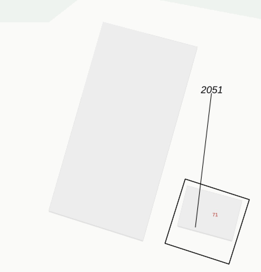
EDIT: My gml file holds place coordinates for a label (parcel id) and two fields deltaX and deltaY to shift the label position on the map for presentation reasons. See the image for an example.
In the conversion from gml to geojson I like to achieve two additional tasks:
In the earlier discussed conversion cycle for the place coordinates, change the given place coordinates (X and Y) by adding deltaX and deltaY before converting the projection from EPSG:28992 to EPSG:4326 (as deltX and deltaY seem to be in EPSG:28992 units)
Create a separate additional geojson file holding a line geometry from the original place coordinates to the changed place coordinates, for those features only where deltaX<>0 or deltaY<>0
These two steps should enable my to recreate the given example in the image attached. In what way should I setup the ogr2ogr command for this purpose?


