1

Using QGIS + Grass, I've added a shapefile of coastline and islands to my map.

I then buffer this shapefile to create a coastal zone of a known width. At this stage the buffer consists of the offshore (buffered) area + the area occupied by the land/ islands. As I am only interested in the offshore part, I then "clip" the land shapefile from the buffer.

I have tried this using both Vector>Geoprocessing Tools>Difference and GRASS v.overlay.xor. Either approach results in geometry errors (lots of them).

e.g.,

segments 0 and 24 of line 43 intersect at xx.xxx, yy.yyyy

This appears to be due to narrow connections between land areas (yellow in the picture below) resulting in intersecting nodes after the ocean (blue) is clipped.
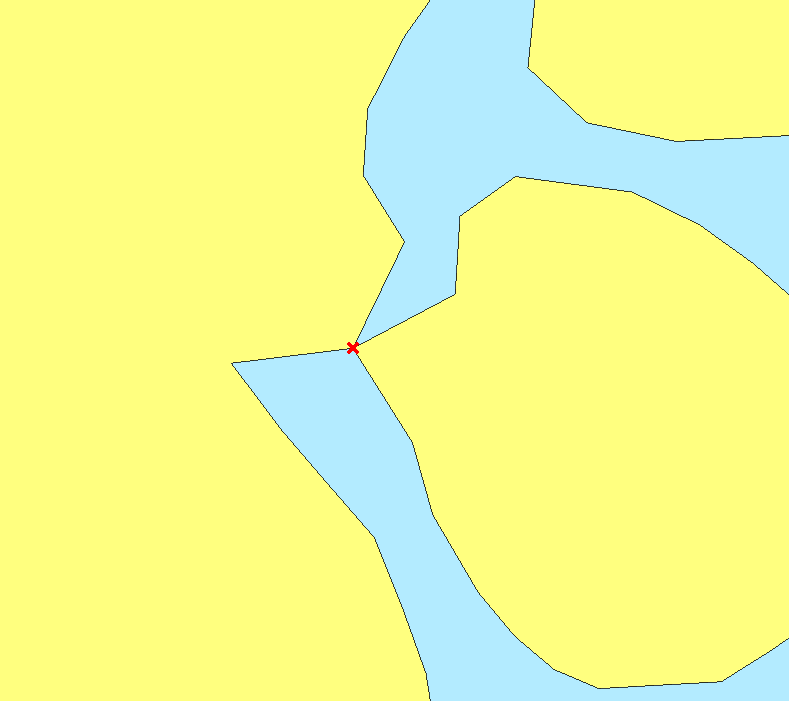
enter image description here

My land data comes from an external source, and I don't have a lot of scope to simplify or adjust this.

What is the best way to handle these errors, or to avoid them in the first place?

I'm not a GIS expert, so there's a good chance that I'm approaching this problem from the wrong end. Would appreciate any tips or advice to avoid these errors.

6
  • If you'd buffer the land polygon layer, you'd only get the off-shore part, right? No further steps necessary. Or am I missing something here?
    – underdark
    Commented Jan 21, 2013 at 19:33
  • Thanks for your comment @underdark. Yes, that's what I was expecting, but in my case the land part is also added. For example, I buffer a circular island, and the resulting shapefile consists of the area of the island + the area of the buffer. Any ideas why this might be happening? Commented Jan 22, 2013 at 11:19
  • Right, sorry for the confusion, my fault. Did you test validity of the land polygon? I think it might also fail the test. A quick fix should be to move the nodes at the problematic spot apart a little.
    – underdark
    Commented Jan 22, 2013 at 11:23
  • No need to apologies, my explanation of the problem is probably at fault. When I run Vector>Geometry Tools>Check geometry validity no errors are detected. Is there a comparable command in GRASS to double check? Commented Jan 22, 2013 at 11:52
  • Curious: Which GRASS GIS version are you using?
    – markusN
    Commented Feb 12, 2013 at 20:43

0

Your Answer

By clicking “Post Your Answer”, you agree to our terms of service and acknowledge you have read our privacy policy.

Browse other questions tagged or ask your own question.