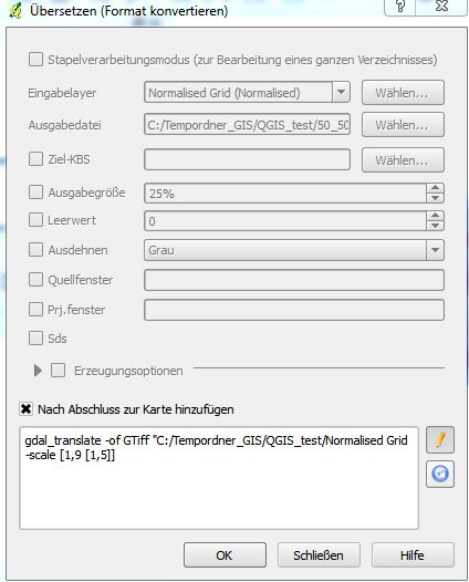
I do not understand the command line when I try to work with gdal_translate in QGIS. I found this at the forum: Normalize raster values to 0-255
And tried this:
"If not, from within QGIS choose Raster -> Conversion - > Translate. Choose your files and options. At the bottom of the window the full gdal_translate command will be displayed. Click edit and add the -scale option."
When I type the following command into the line I get an error message "wrong parameters"??? Maby the commands are wrong.

My current grid file has a range from 1 to 9. I need to have a range from 1 to 5 (5 classes).

-scale 1 9 1 5? In general, try running it from the command line as it should give you more descriptive error messages.gdal_translate "C:/Tempordner/Your/Input/Image.tif -scale 1 9 1 5 -of GTiff "C:/Tempordener_GIS/QGIS_test/Normalised_Grid.tif"gdal_translate "C:/Tempordner/Your/Input/Image.tif" -scale 1 9 1 5 -of GTiff "C:/Tempordener_GIS/QGIS_test/Normalised_Grid.tif"