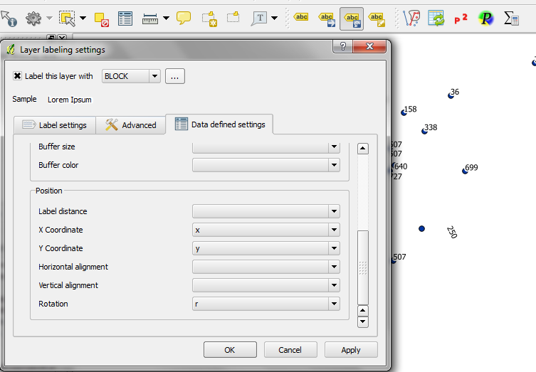
Mac OSX 10.6.8 QGIS 1.8.0 : I'm mapping an area that's a rectangle slanted at 26 degrees, and neighbourhood maps are always printed so the rectangle is horizontal. I'm trying to make the labels readable when printed that way.
In advanced settings the placement 'around centroid' shows a rotation option, but it's greyed out and unresponsive; none of the other options allow specifying a label orientation. The move/rotate tools of ABC are also greyed out and unresponsive. (The 'free' setting puts labels everywhichway and is very awkward to read.) I've added x, y and rotation attribute fields (type real) and enabled editing.
Might there be a way of enabling the rotation field that I haven't spotted? Or, something else that will have a similar effect?

