10

I downloaded an LPK file from the Esri site that contains USPS defined zip codes. I'm working with QGIS on a Mac, so I converted the file to a .zip. There's a .lyr file that opened up in the zip, but I'm not able to open that up on QGIS.

Is there a way to convert the contents of an Esri layer package file (.lpk) into a shapefile with the associated data, and that I can open with QGIS on a Mac?

I looked into using utilities like 7-zip, but it doesn't seem to work on a Mac.

Apparently one of the .xml files in the layer package should contain a link to the actual data under the packagelocation tag, but I wasn't able to find that tag in the .xml files.

Does anyone know if that tag name might have switched?

0

5 Answers 5

9

From the Comments it appears that the asker solved this by unzipping the *.lpk to find a *.sdc file that was then converted to shapefile format using instructions from NCSU Libraries' Geospatial Data Formats page:

With ESRI Data and Maps 2006, a standalone "Data Distribution Application" was included that converts SDC data files directly to shapefiles. This application may be downloaded from the Geodata Server at http://gisdata.lib.ncsu.edu/esri2006/data_maps/DDA/ [needs credentials] or off-campus from here [needs authentication]. A help file is also included at this download location.

0
6

You just need 7zip. The archives that Esri uses are basically zip files but winzip and windows default zipping does not work. Use 7zip to unzip a layer package LPK,OR Mobile map package or VTPK or TPKX

0
3

If you're looking for zip code boundaries in other formats, you should turn to the US Census Bureau:

Go to: http://www.census.gov/cgi-bin/geo/shapefiles2013/main and choose "zip code tabulation area"

1
  • 1
    ZCTAs are not zip codes, which are used the USPS. ZCTAs are a Census Bureau invention roughly based on zipcodes but tailored to their needs. I've seen some estimates put the correlation to be only ~80%
    – winwaed
    Commented Sep 17, 2019 at 3:12
2

Right click and extract the .lpk file using unzipping software. With a certain lpk file I then searched around and found a folder in the extraction that contained shapefiles.

0
0

Disclaimer I work here.


You can get US Zipcode Boundaries via this API:

https://www.boundaries-io.com

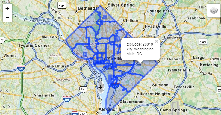
The API shows US Boundaries(GeoJson) by zipcode,city, and state. you should use the API programatically to handle large results.

enter image description here

2
  • 1
    This website seems to have gone offline sometime since the answer was posted.
    – larsks
    Commented Feb 27, 2022 at 22:25
  • @larsks boundaries-io.com is the company page ,thanks.i will update the answer..MashApe was brought out by RapidAPI which hosts. Thanks.
    – Jeryl Cook
    Commented Feb 28, 2022 at 23:20

Your Answer

By clicking “Post Your Answer”, you agree to our terms of service and acknowledge you have read our privacy policy.

Not the answer you're looking for? Browse other questions tagged or ask your own question.