I have a footprint feature class and a land use cluster feature class. I am looking for a method/tool/script that would allow me:
- to reshape two edges into one (topologically)
- to decide at which distance it can be set
- and to run the process automatically.
The outcome will be used into an hydraulic model, so it has to have the minimum amount of vertex as possible and still keep the main orthogonal shape of the footprint.
I have looked around and found some very interesting tools , although requiring a lot of manual editing.
Has anyone already see or used something similar?
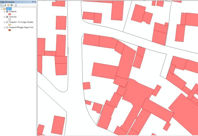
First image shows the original Data (2 layers, so no gap to fill)

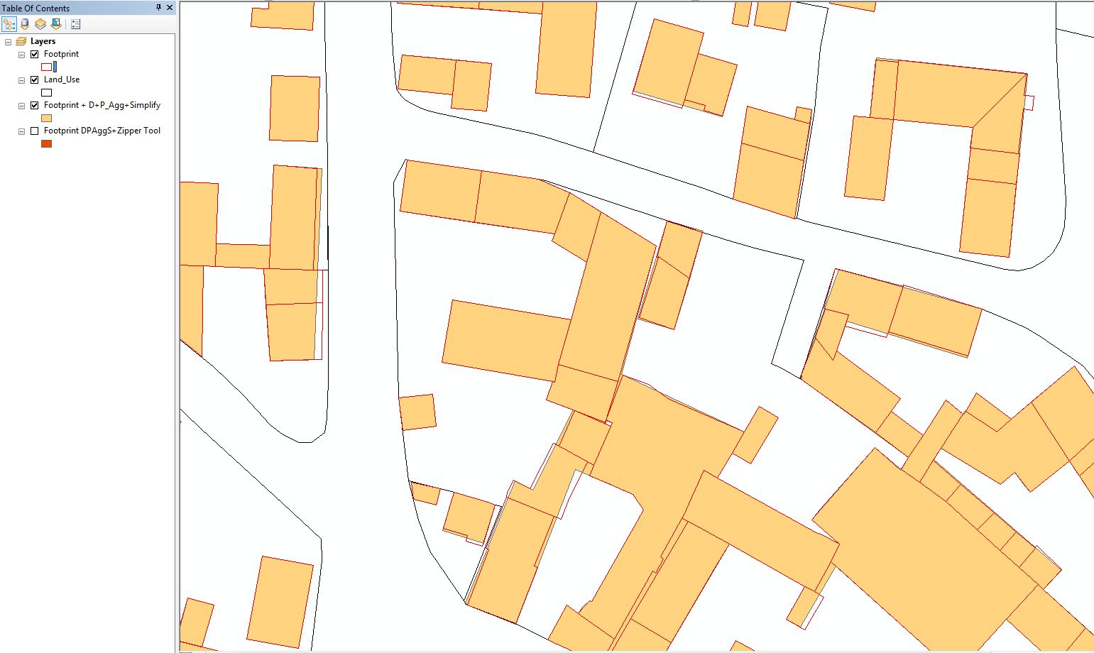
The second image shows the first steps used toward the simplification of the footprint (red lines are original footprint): : Dissolve (No Multipart), Aggregate polygon (1 m distance and with option Keep orthogonal shape), simplify building.

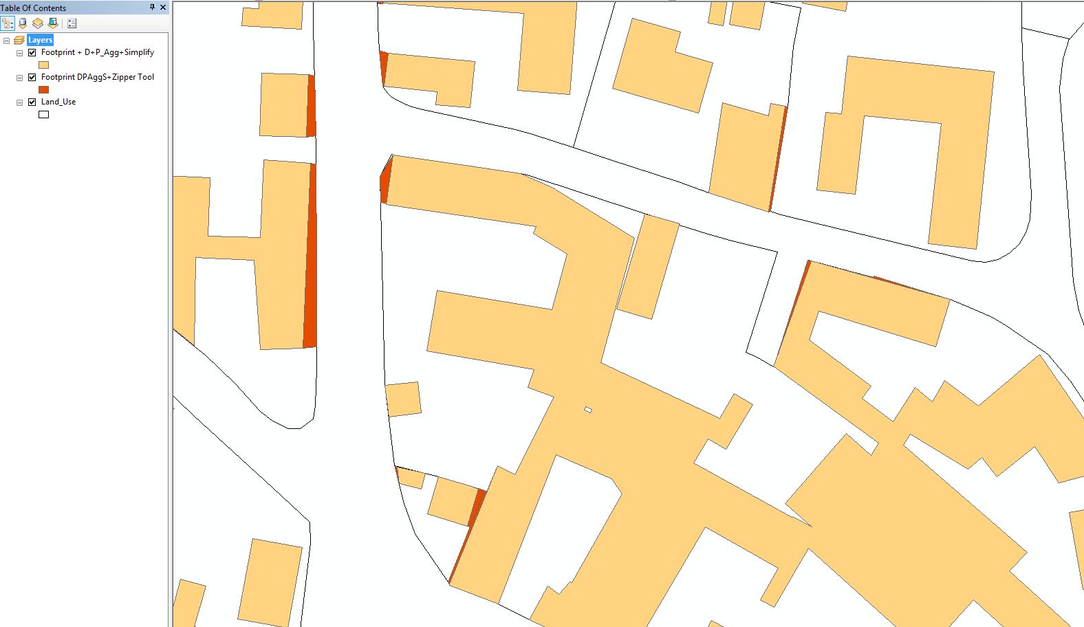
The third image shows what I'd like to achieve although without the manual editing, I have here tried the Zipper tool: extension of one of side of a building'sfootprint to the next adjacent land use polygon (dark orange area show the extension).

