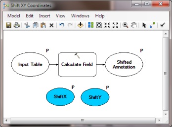
I have a number non-georeferenced CAD layers (see this question) that have text annotation features. I have created a model to convert the text to points, but after converting the annotation to a Point featureclass, I see that the CAD text anchor points do not coincide with the center of the CAD text (which is where the points belong).
Therefore, I would like to programatically (using ArcPy or ModelBuilder) [move] a feature relative to its current location (delta x,y) using a measured X,Y value that I will provide.
This would allow me to move the GIS points back to where they belong, instead of the offset CAD anchor point.
How can I accomplish this task?
@PolyGeo gave an excellent answer using SHAPE@XY IN 10.1, but currently I am running 10.0. Any 10.0 ideas?

