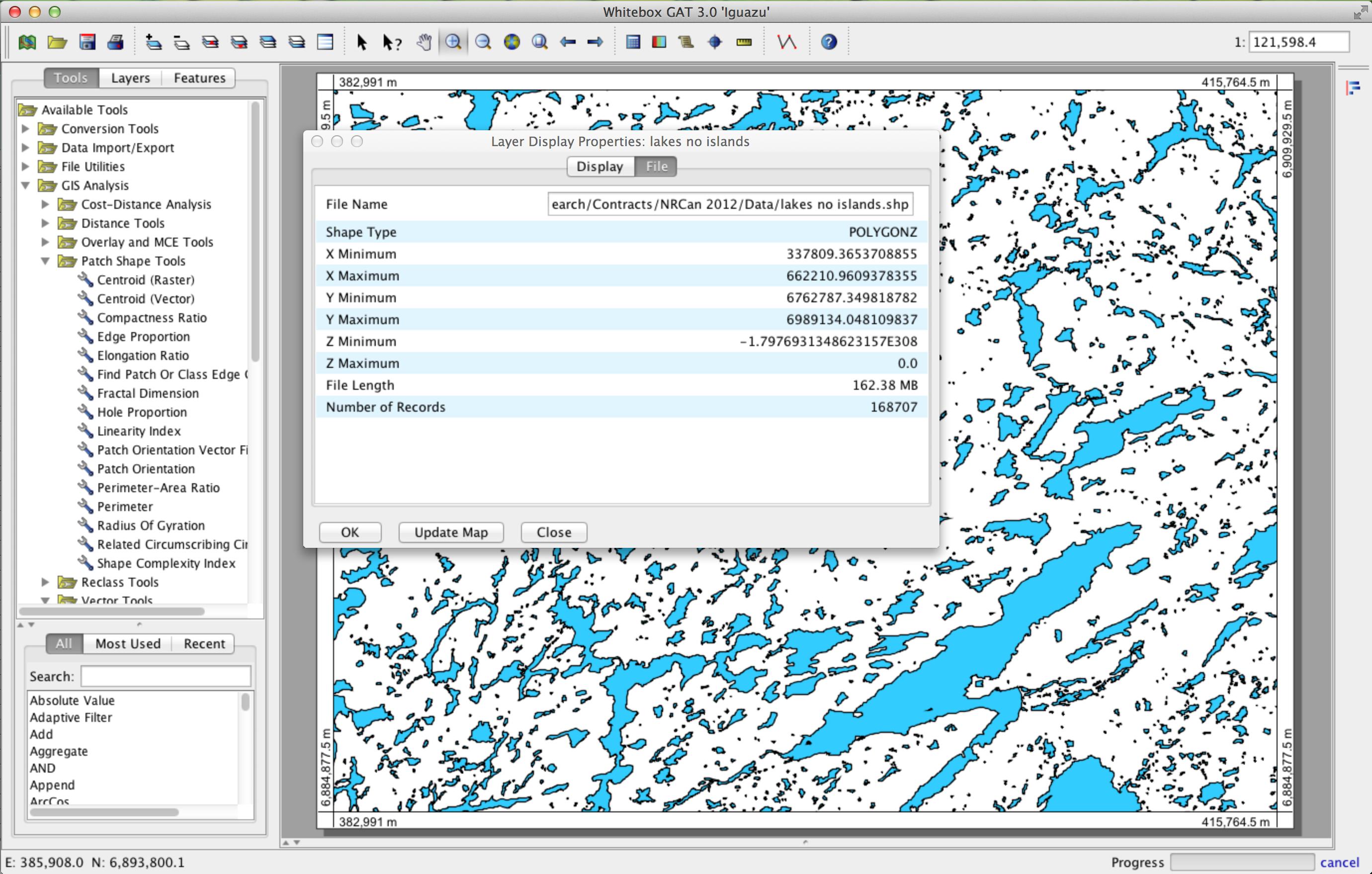
I'd suggest using the cross-platform, open source GIS Whitebox GAT (http://www.uoguelph.ca/~hydrogeo/Whitebox/). I had a contract last year that involved extracting complex shape characteristics of 168,707 lakes in the arctic, with a total of 1,786,312 nodes within the features. It performed the analysis without crashing a single time and the processing time was certainly reasonable (as in minutes not hours).

EDIT:
Okay, here's a script that you can use to find the centroid based on a grouping ID field in a shapefile's attribute table. You simply need to open the Whitebox Scripter (scroll icon on toolbar), change the scripting language to Groovy, paste the code, save it, and run it. I tested it on my lakes coverage, which has 1,786,312 node points, using the Lake ID as the grouping field. It took 165.6 seconds to complete the operation on my i7 quad core machine. If that isn't fast enough for you, I can look into parallelizing the script. I was in a bit of a rush when I wrote it, so I hard coded it instead of making a dialog that would allow you to specify your own files. As such, you need to change the commented lines at the very bottom of the script to reflect your input file name, the field used for grouping, and the output file name. Good luck and let me know how it goes for you.
/*
 * Copyright (C) 2013 Dr. John Lindsay <[email protected]>
 *
 * This program is free software: you can redistribute it and/or modify
 * it under the terms of the GNU General Public License as published by
 * the Free Software Foundation, either version 3 of the License, or
 * (at your option) any later version.
 *
 * This program is distributed in the hope that it will be useful,
 * but WITHOUT ANY WARRANTY; without even the implied warranty of
 * MERCHANTABILITY or FITNESS FOR A PARTICULAR PURPOSE.  See the
 * GNU General Public License for more details.
 *
 * You should have received a copy of the GNU General Public License
 * along with this program.  If not, see <http://www.gnu.org/licenses/>.
 */

import java.io.File
import whitebox.geospatialfiles.ShapeFile
import whitebox.geospatialfiles.shapefile.ShapeType
import whitebox.geospatialfiles.shapefile.*
import whitebox.geospatialfiles.shapefile.Point
import whitebox.geospatialfiles.shapefile.attributes.AttributeTable
import whitebox.geospatialfiles.shapefile.attributes.DBFField
import whitebox.geospatialfiles.WhiteboxRasterBase
import whitebox.interfaces.WhiteboxPluginHost
import whitebox.stats.TwoSampleKSTest;
import groovy.transform.CompileStatic

@CompileStatic
class CentroidByGrouping {
private WhiteboxPluginHost pluginHost

CentroidByGrouping(WhiteboxPluginHost pluginHost) {
    this.pluginHost = pluginHost
}

public void run(String[] args) {
    def timeStart = System.nanoTime()

    try {
        // declare variables
        def inputFile = args[0]
        def input = new ShapeFile(inputFile)
        ShapeType st = input.getShapeType()
        def fieldName = args[1]
        def outputFile = args[2]

        int i
        double x, y
        int progress
        int parentID

        DBFField[] fields = input.attributeTable.getAllFields()
        def fieldNum = -1;
        for (i = 0; i < fields.length; i++) {
            if (fields[i].getName().equals(fieldName)) {
                fieldNum = i
                break
            }
        }

        if (fieldNum < 0) {
            pluginHost.showFeedback("Could not find the field of interest.")
            return
        }

        DBFField[] outputFields = new DBFField[1];
        outputFields[0] = new DBFField()
        outputFields[0].setName("GROUP_ID")
        outputFields[0].setDataType(DBFField.DBFDataType.NUMERIC)
        outputFields[0].setFieldLength(10)
        outputFields[0].setDecimalCount(0)

        ShapeFile output = new ShapeFile(outputFile, ShapeType.POINT, outputFields);

        int numRecords = input.getNumberOfRecords()

        // find the minimum, maximum and the number of groups based on the Grouping ID
        int minVal = 9999999
        int maxVal = -9999999

        int oldProgressValue = -1
        int recNum = 0;
        for (ShapeFileRecord record : input.records) {
            parentID = record.getRecordNumber()
            Object[] attributes = input.attributeTable.getRecord(parentID - 1)
            i = (int)attributes[fieldNum]
            if (i < minVal) { minVal = i }
            if (i > maxVal) { maxVal = i }

            // update the progress
            recNum++
            progress = (int) (100f * recNum / numRecords)
            if (progress != oldProgressValue) {
                pluginHost.updateProgress("Loop 1 of 3", progress)
                oldProgressValue = progress
            }
            // check to see if the user has requested a cancellation
            if (pluginHost.isRequestForOperationCancelSet()) {
                pluginHost.showFeedback("Operation cancelled")
                return
            }
        }
        int numGroups = maxVal - minVal + 1
        println minVal
        println maxVal
        println numGroups

        // find the centroid of each group
        int[] numPointsInGroup = new int[numGroups]
        double[] totalXInGroup = new double[numGroups]
        double[] totalYInGroup = new double[numGroups]
        double[][] points
        oldProgressValue = -1
        recNum = 0;
        for (ShapeFileRecord record : input.records) {
            parentID = record.getRecordNumber()
            points = record.getGeometry().getPoints()
            Object[] attributes = input.attributeTable.getRecord(parentID - 1)
            i = ((int)attributes[fieldNum]) - minVal
            numPointsInGroup[i]++
            totalXInGroup[i] += points[0][0]
            totalYInGroup[i] += points[0][1]

            // update the progress
            recNum++
            progress = (int) (100f * recNum / numRecords)
            if (progress != oldProgressValue) {
                pluginHost.updateProgress("Loop 2 of 3", progress)
                oldProgressValue = progress
            }
            // check to see if the user has requested a cancellation
            if (pluginHost.isRequestForOperationCancelSet()) {
                pluginHost.showFeedback("Operation cancelled")
                return
            }
        }

        // now output the centroid points
        oldProgressValue = -1
        for (i = 0; i < numGroups; i++) {
            if (numPointsInGroup[i] > 0) {
                x = totalXInGroup[i] / numPointsInGroup[i]
                y = totalYInGroup[i] / numPointsInGroup[i]
                whitebox.geospatialfiles.shapefile.Point wbGeometry = new whitebox.geospatialfiles.shapefile.Point(x, y);
                Object[] rowData = new Object[1];
                rowData[0] = new Double(i + minVal);
                output.addRecord(wbGeometry, rowData);
            }
            progress = (int)(100f * i / (numGroups - 1))
            if (progress != oldProgressValue) {
                pluginHost.updateProgress("Loop 3 of 3", progress)
                oldProgressValue = progress
            }
            // check to see if the user has requested a cancellation
            if (pluginHost.isRequestForOperationCancelSet()) {
                pluginHost.showFeedback("Operation cancelled")
                return
            }
        }

        output.write()

        // displays the final shapefile
        pluginHost.returnData(outputFile)

    } catch (Exception e) {
        pluginHost.showFeedback(e.getMessage())
    } finally {
        def timeStop = System.nanoTime()
        pluginHost.showFeedback("Operation completed in ${((timeStop - timeStart)  / 1000000000.0)} seconds")
    }
}

}


String[] myArgs = new String[3]
// the input shapefile
myArgs[0] = "/Users/johnlindsay/Documents/Research/Contracts/NRCan 2012/Data/LakeFilePnts/lakepoint.shp"
// the name of the field used for grouping
myArgs[1] = "PARENT_ID"
// the name of the output centroid points shapefile
myArgs[2] = "/Users/johnlindsay/Documents/Research/Contracts/NRCan 2012/Data/LakeFilePnts/points centroid.shp"
def centroid = new CentroidByGrouping(pluginHost)
centroid.run(myArgs)


Rare well-known and free) will provide quick, efficient solutions.