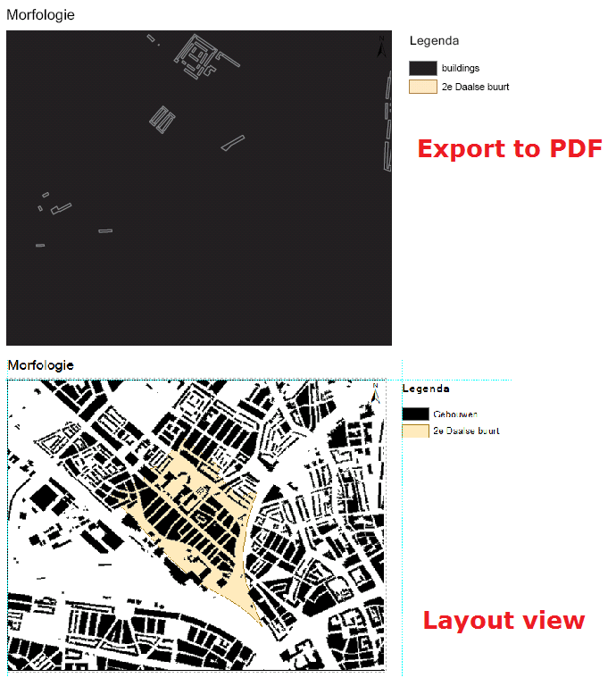
I have an issue with ArcMap. In the layout view and data view it shows all buildings normal (it's a bit blurry, but it's only for a study not for presentation), but when I export it, all gaps between the buildings get filled. I don't know what the error could be and first thought it would be in some export setting, but it isn't. I made an EMF and inserted the picture in ArcMap and the EMF was filled in too.

Some more background information: All files are shapefiles (vector) When I export just the layer with the building information all works fine.
