2

I would like to make several map images (e.g. SVG or PNG) like those on wikipedia but in not popular projection. I am interested in scripting solution.

Here I found this note:

Generation Notes
perl xml2svg.pl -P12 --proj=cylindrical_equidistant:0,0.793353340291235 -x8000 world98

(I haven't found this script yet. Where is it?)

Also I found mentions of Generic Mapping Tools and Mapnik.

There are also several other flavors of maps on Wikipedia. I believe, more ways to create a map images exist.

So what are preferred map rendering techniques and datasets for Wikipedia?

2 Answers 2

5

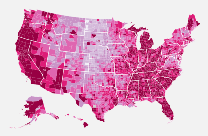
As far as I understand, you want to make Thematic Mapping with python and svg. you can find very good tutorial here about How to Make a US County Thematic Map Using Free Tools.

.

1
  • Sorry, my question is more about creating svg map, not just colorizing existent. Though I will do use similar technique later on. Thanks. Commented Sep 25, 2013 at 16:03
2

Maybe you're interested in Kartograph.py. You could use it from command line or as a python module.

OpenStreetMap should be a good data source for wikipedia maps as well as Natural Earth data or open data portals.

1
  • Thanks! It was the first thing I tried. Unfortunately it seems to be abandoned for a while. I could not solve this issue. Also, shapely(toblerity.org/shapely/manual.html) is not fast for my purposes and it produced strange results (I gave up, as i am not very experienced in GIS and Python). Mapnik really looks more fast and stable. I am learning it now. In the question I tried to ask about popular and convenient libraries/programs for images intended to be used on Wikipedia (Best practices) Commented Sep 25, 2013 at 19:43

Your Answer

By clicking “Post Your Answer”, you agree to our terms of service and acknowledge you have read our privacy policy.

Not the answer you're looking for? Browse other questions tagged or ask your own question.