3

i have question ho to create raster from QGIS map canvas (what i seen in my qgis) easily. Now i have used print composer and after some luck i get whole dataset into map item, after that i throw lucky guess for dpi and i get something.

What i would like to do is : make map look pretty in qgis, select cell resolution and get what i see in georeferenced raster file (geotiff, png etc..) from whole dataset. is this possible or do i just use print composer wrong ?

3 Answers 3

2

This is a new feature in QGIS 2.2 Print Composer to be released in late February:

http://changelog.linfiniti.com/qgis/version/21/ (# Feature: World file generation)

6
  • does this also fix problem that it is not intuitive to define generated raster cell size etc. ? Also do you have download link for windows , i dont seem to find it anywhere Commented Jan 28, 2014 at 14:29
  • 2
    You can install version 2.1, which is the development version that will become 2.2 with the OSGeo4W installer. Select "Advanced Install" then in the Desktop section choose qgis-dev. Commented Jan 28, 2014 at 15:11
  • Almoust works as needed, i just dont get high resolution out of it. Map area / page size / dpi are good guess , and when i get 20kx20k pixels it wont work (out of memory). sight, I just want make retangle in qgis "canvas" windows , set cell size to 0.5m and get x amount of rasters which i can load in qgis ( well, actually send them to our geoserver admin ). Maybe FME manages fix their mapnikRenderer so i can get those pesky cyrillic characters to map. Or i still use this wrong way. Commented Jan 29, 2014 at 14:18
  • this is closest i get to what i want. Commented Jan 30, 2014 at 7:51
  • I did : PrintComposer , added Map view , page size = 500mmx500mm, defined scale = 1000 and dpi =500. set world file generation. I enabled atlas and select export as image. Results looks good , but for some reason qgis renders some "tiles" twice (difference is few meters in world file) (i use latest qgis weekly (2.1.0-54 ) Commented Jan 30, 2014 at 10:23
1

Look for "Save as Image..." in the File menu. Select an image format and you get an image file and a word file (georeference). The resolution of the raster image will be the same as the canvas.

If you need high resolution raster and world file together, you can use the commandline parameters of QGIS e.g. --project, --snapshot, --width, --height, --extent

3
  • i dont get this work : C:\OSGeo4W64>qgis --noplugins --project C:\\TMP\\this.qgs --snapshot res3.png --width 200 --height 200 I have tried 2.0 dufor , and "latest" Qgis Weeksly which is 2.1.54 i think. Commented Jan 29, 2014 at 14:10
  • this doesn't work on my setup , Qgis Weekly standalone , OsgeoW64bit (2.01 qgis). Only result i get is that qgis is waiting whole night , takes x amount (depending width and height) RAM. Commented Jan 30, 2014 at 7:49
  • In QGIS documentation (qgis.org/en/docs/user_manual/introduction/…) the command line parameters are marked by Linux logo (supported on Linux). Some commandline parameters works on Windows too, for example --lang --project, but --help --snapshot don't work.
    – Zoltan
    Commented Jan 30, 2014 at 16:31
1

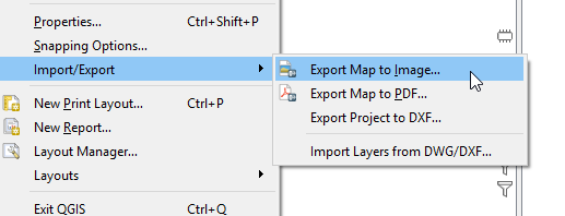
In QGIS 3, you can: File 🡆 Import/Export 🡆 Export Map to Image...

enter image description here

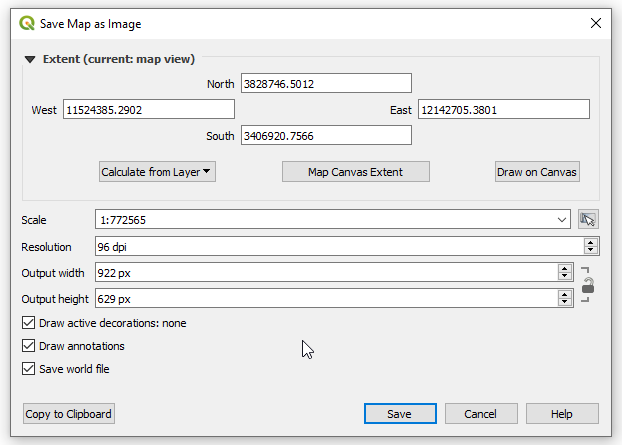
And you will have options to choose the extent: enter image description here

Your Answer

By clicking “Post Your Answer”, you agree to our terms of service and acknowledge you have read our privacy policy.

Not the answer you're looking for? Browse other questions tagged or ask your own question.