I don't have a solution through ArcMap, but you can do it easily through Mapinfo Advanced.
Just open up your file in Mapinfo and Go to Raster Tab. After that go to operations and select Calculator tool.
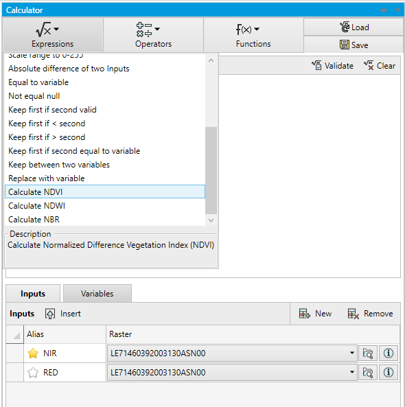
In calculator tool select Red and NIR band from the input.
From Operations drop-down select NDVI. And click calculate button.

The output that you will get will have NDVI range from -1 to 1. And it's fast.
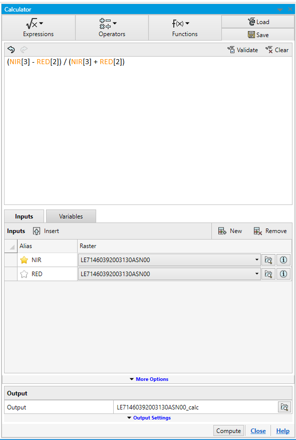
So in the example i have a Landsat 7 img file. And i am running NDVI analysis on it.
Also please note that Mapinfo follows 0 based index for different bands. So Landsat 7 has NIR at band 4 then you will need to select 3 in calculator tool.

