As @ianturton points out, a geopackage only contains the CRS info needed. You can confirm this using sqlite (Geopackages are sqlite databases)
sqlite3 my.gpkg
$sqlite > select count(*) from gpkg_spatial_ref_sys;
4
$sqlite > .quit
(in my example it added 2 'null' CRSes, WGS84 and the projection I was using)
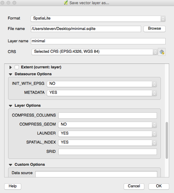
If you need to save it as Spatialite, there's a secret option hiding in the save dialog, called 'INIT_WITH_EPSG'. It's quite well hidden, I only just spotted this - you need to scroll down. See screenshot. Set that to No and save.
You should now find that only the required projection is saved.

