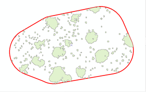
I normally do not work with shapefiles, so I am a bit lost here. I have two shapefiles each with multiple objects. The first is a set of 32 polygons (each one is a plot). The second shapefile has >10,000 objects which represent vegetation clusters of different sizes within each plot. I am trying to figure out:
How do I calculate percent cover of total vegetation cover within each site?
What percentage of each the vegetation cover is less than 5 meters in area in each plot?
This is what my data looks like in ArcGIS for a single plot. I am open to advice on how to do this in arcGIS too.

