deleted 208 characters in body; edited title
Source Link
underdark
  • 84.5k
  • 22
  • 233
  • 415

QGIS: How to combine 2 vector shapes created from raster files

Ok this is a complicated question, so I'll try to be as clear as possible:

In Qgis 2.12 Lyon, using windows 10

I downloaded 2 raster files from an area of my interest. The rasters were on information about precipitation and evapotranspiration. Each cell had a value. I wanted to combine the information from both. It means: Calculate for each cell, the difference between precipitation and evapotranspiration. I didn't know why, but couldn't find the way to do it in raster files. So I thought, let's convert these files in vector polygon files, so each cell now becomes a polygon with a value. My intention was to have the attribute table with all the cells and do the difference with the calculator.

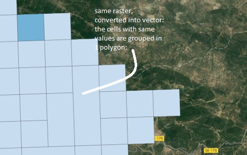
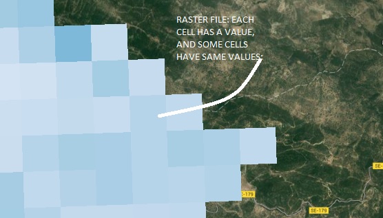
But the thing is, when I polygonized (converted the raster into vectors) Some of the cells, are grouped, so 3 cells form a polygon, making it difficul for me to create a combination, or a calculation, cell-by-cell.

See images; enter image description here enter image description here

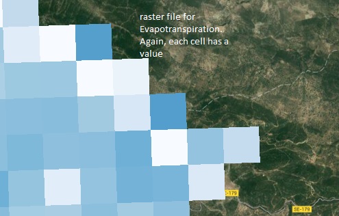
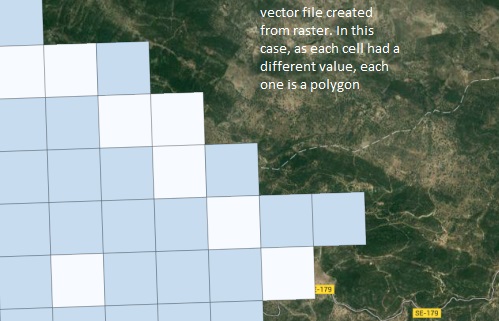
These were the images for precipitation info. Look what happens with the ET:

enter image description here enter image description here

My wish would be to combine both vector shapes, and calculate the difference for each cell, but if the polygons are each one different.... How could I do it?

I know the question is quite hard to explain, I tried my best, so any help would be more than welcome!!

Thanks in advance Alex
How to combine 2 vector shapes created from raster files

In Qgis 2.12 Lyon, using windows 10

I downloaded 2 raster files from an area of my interest. The rasters were on information about precipitation and evapotranspiration. Each cell had a value. I wanted to combine the information from both. It means: Calculate for each cell, the difference between precipitation and evapotranspiration. I didn't know why, but couldn't find the way to do it in raster files. So I thought, let's convert these files in vector polygon files, so each cell now becomes a polygon with a value. My intention was to have the attribute table with all the cells and do the difference with the calculator.

But the thing is, when I polygonized (converted the raster into vectors) Some of the cells, are grouped, so 3 cells form a polygon, making it difficul for me to create a combination, or a calculation, cell-by-cell.

See images; enter image description here enter image description here

These were the images for precipitation info. Look what happens with the ET:

enter image description here enter image description here

My wish would be to combine both vector shapes, and calculate the difference for each cell, but if the polygons are each one different.... How could I do it?

Source Link

QGIS: How to combine 2 vector shapes created from raster files

Ok this is a complicated question, so I'll try to be as clear as possible:

In Qgis 2.12 Lyon, using windows 10

I downloaded 2 raster files from an area of my interest. The rasters were on information about precipitation and evapotranspiration. Each cell had a value. I wanted to combine the information from both. It means: Calculate for each cell, the difference between precipitation and evapotranspiration. I didn't know why, but couldn't find the way to do it in raster files. So I thought, let's convert these files in vector polygon files, so each cell now becomes a polygon with a value. My intention was to have the attribute table with all the cells and do the difference with the calculator.

But the thing is, when I polygonized (converted the raster into vectors) Some of the cells, are grouped, so 3 cells form a polygon, making it difficul for me to create a combination, or a calculation, cell-by-cell.

See images; enter image description here enter image description here

These were the images for precipitation info. Look what happens with the ET:

enter image description here enter image description here

My wish would be to combine both vector shapes, and calculate the difference for each cell, but if the polygons are each one different.... How could I do it?

I know the question is quite hard to explain, I tried my best, so any help would be more than welcome!!

Thanks in advance Alex