2

In Qgis 2.12 Lyon, using windows 10

I downloaded 2 raster files from an area of my interest. The rasters were on information about precipitation and evapotranspiration. Each cell had a value. I wanted to combine the information from both. It means: Calculate for each cell, the difference between precipitation and evapotranspiration. I didn't know why, but couldn't find the way to do it in raster files. So I thought, let's convert these files in vector polygon files, so each cell now becomes a polygon with a value. My intention was to have the attribute table with all the cells and do the difference with the calculator.

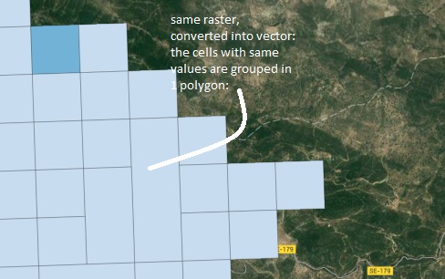
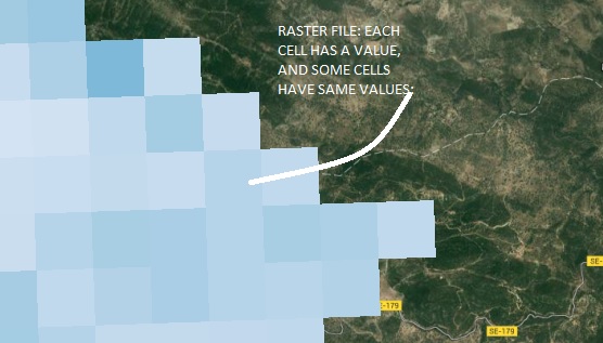
But the thing is, when I polygonized (converted the raster into vectors) Some of the cells, are grouped, so 3 cells form a polygon, making it difficul for me to create a combination, or a calculation, cell-by-cell.

See images; enter image description here enter image description here

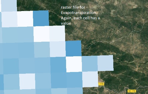
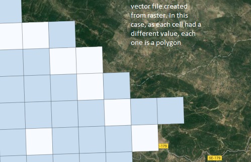
These were the images for precipitation info. Look what happens with the ET:

enter image description here enter image description here

My wish would be to combine both vector shapes, and calculate the difference for each cell, but if the polygons are each one different.... How could I do it?

1 Answer 1

1

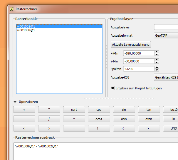
I want to step back to your original intend of combining rasters. When you have both rasters loaded, then open Raster -> Raster Calculator from the menu.

In the next dialog you will see a list of currently available raster dataset. You can define an algebraic formula by simple clicking of raster bands from the upper left list, and operators. In the example below band 1 (the only one) of raster w001002 is subtracted from band 1 of raster w001008.

Raster calculator

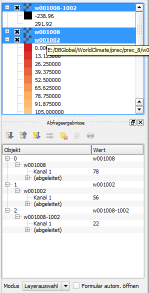
As you see in the next picture a cell from the resulting raster, here w001008-1002, contains exactly the difference.

Difference

You gave already the explanation for what happens when rasters are being converted to polygons: neighboring cells having the same value are grouped to zones.

If you really want to do raster algebra with polygons, you first have to union the polygon layers. This will intersect polygons from both layers and join there attributes. Then you can use field calculator to do the same math with field values.

1
  • thanks sooo much. I think I was trying to complicate myself more than needed. It is clear that the solution was so much simple than what I was trying to do. I tried it with my 2 rasters and yes, it worked. Commented Jan 25, 2016 at 16:23

Your Answer

By clicking “Post Your Answer”, you agree to our terms of service and acknowledge you have read our privacy policy.

Not the answer you're looking for? Browse other questions tagged or ask your own question.