correct spelling
Source Link
Jochen Schwarze
  • 14.9k
  • 8
  • 54
  • 120

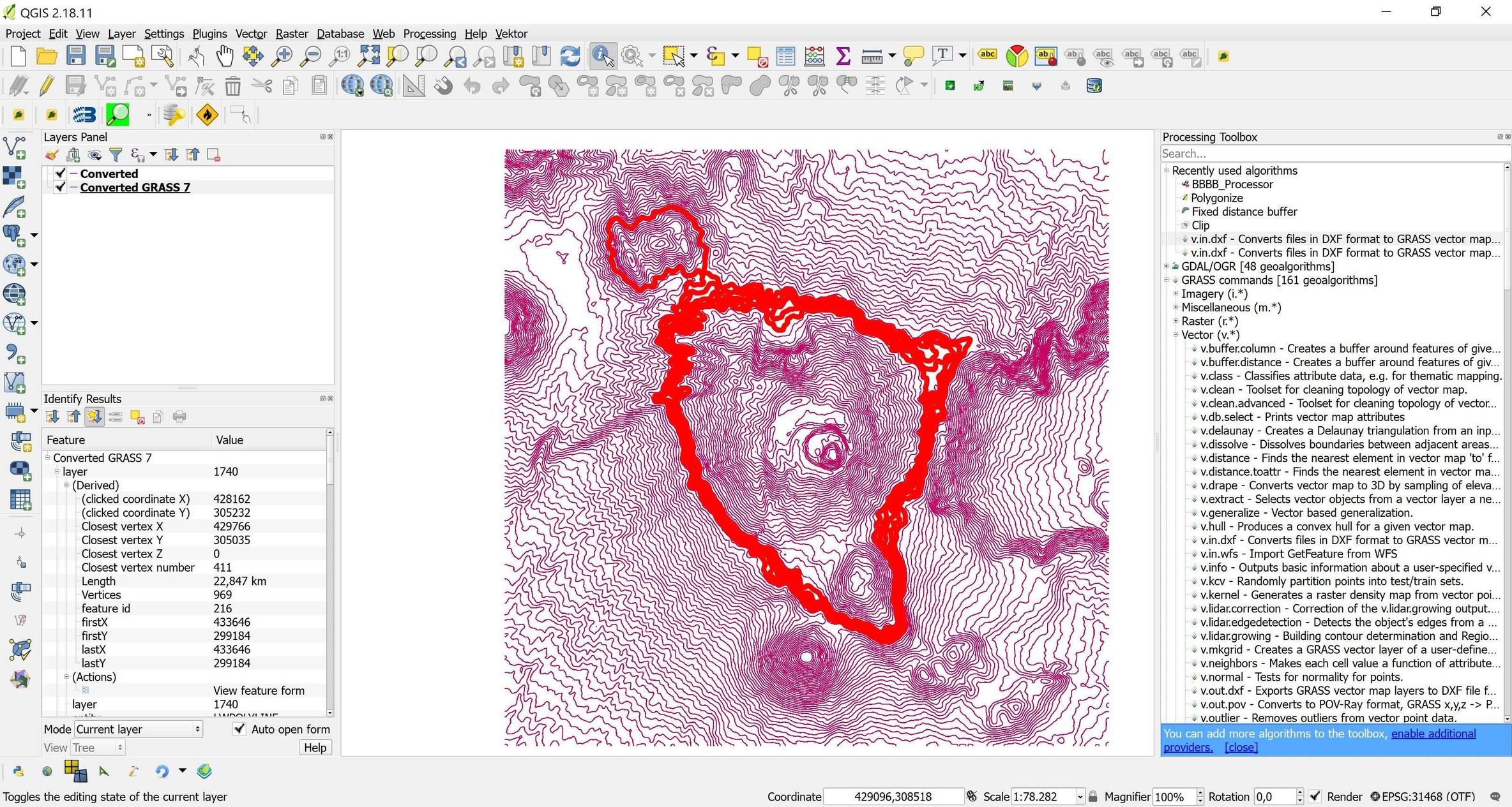
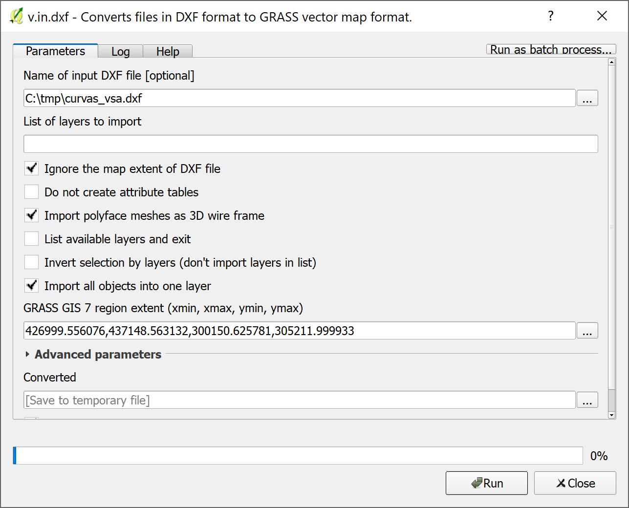
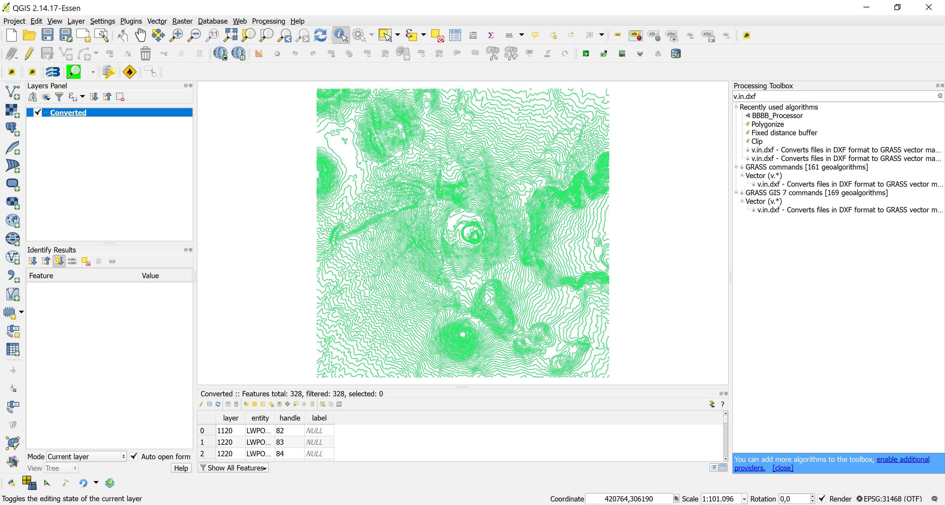
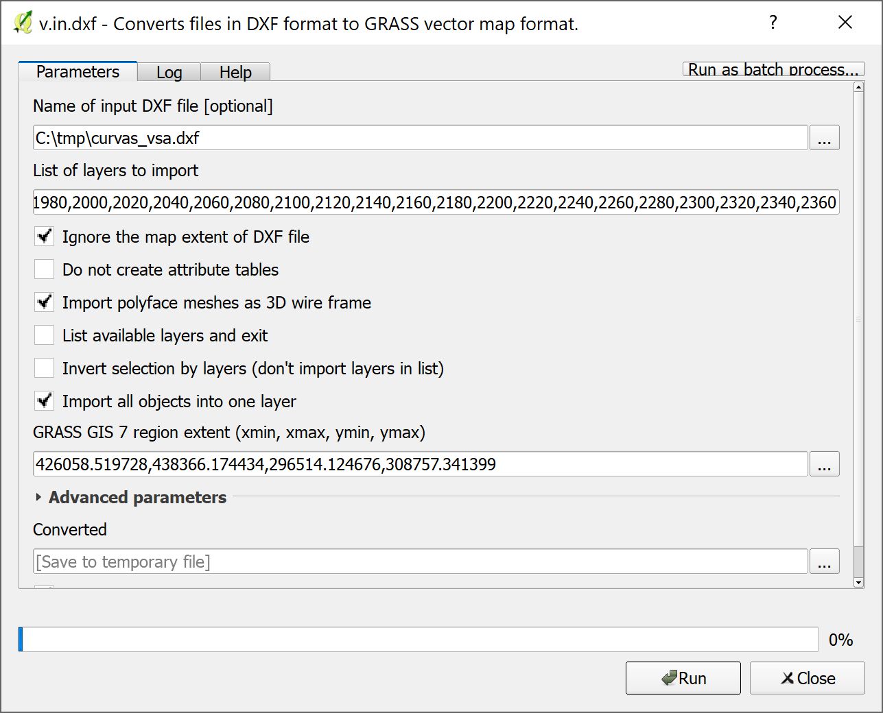
Not sure if it answers your question, but some observations. Bad news first of all, I could not reproduce your issue in QGIS 2.18.11 and QGIS 2.14.17 LTR, both GRASS 6 and 7. Any import worked fine (see screenshots below). The only difference between QGIS 2.14.17 and 2.18.11 is that in QGIS 2.18.11 the 'List of Layers to import' seems mandatory anand cannot be left blank (in order to import ALL layers, as one might expect). The region extent is chosen more or less accidently and does not seem to matter, and I imported all objects into one layer:

Configuration v.in.dxf QGIS 2.14.17 LTR:

enter image description here

Result:

enter image description here

Configuration v.in.dxf QGIS 2.18.11 LTR:

enter image description here

(I did not type the layer list by hand, it's created on the python console via ','.join(['%s'%i for i in range(680, 2380,20)]))

Result:

enter image description here

Note that the Z coordinate of the vertices is always 0, but that the elevations are kept in the layer attribute, from where they can be used for further processing (the same as if it was imported with 'Add Vector Layer').

Not sure if it answers your question, but some observations. Bad news first of all, I could not reproduce your issue in QGIS 2.18.11 and QGIS 2.14.17 LTR, both GRASS 6 and 7. Any import worked fine (see screenshots below). The only difference between QGIS 2.14.17 and 2.18.11 is that in QGIS 2.18.11 the 'List of Layers to import' seems mandatory an cannot be left blank (in order to import ALL layers, as one might expect). The region extent is chosen more or less accidently and does not seem to matter, and I imported all objects into one layer:

Configuration v.in.dxf QGIS 2.14.17 LTR:

enter image description here

Result:

enter image description here

Configuration v.in.dxf QGIS 2.18.11 LTR:

enter image description here

(I did not type the layer list by hand, it's created on the python console via ','.join(['%s'%i for i in range(680, 2380,20)]))

Result:

enter image description here

Note that the Z coordinate of the vertices is always 0, but that the elevations are kept in the layer attribute, from where they can be used for further processing (the same as if it was imported with 'Add Vector Layer').
Not sure if it answers your question, but some observations. Bad news first of all, I could not reproduce your issue in QGIS 2.18.11 and QGIS 2.14.17 LTR, both GRASS 6 and 7. Any import worked fine (see screenshots below). The only difference between QGIS 2.14.17 and 2.18.11 is that in QGIS 2.18.11 the 'List of Layers to import' seems mandatory and cannot left blank (in order to import ALL layers, as one might expect). The region extent is chosen more or less accidently and does not seem to matter, and I imported all objects into one layer:

Configuration v.in.dxf QGIS 2.14.17 LTR:

enter image description here

Result:

enter image description here

Configuration v.in.dxf QGIS 2.18.11 LTR:

enter image description here

(I did not type the layer list by hand, it's created on the python console via ','.join(['%s'%i for i in range(680, 2380,20)]))

Result:

enter image description here

Note that the Z coordinate of the vertices is always 0, but that the elevations are kept in the layer attribute, from where they can be used for further processing (the same as if it was imported with 'Add Vector Layer').
Source Link
Jochen Schwarze
  • 14.9k
  • 8
  • 54
  • 120

Not sure if it answers your question, but some observations. Bad news first of all, I could not reproduce your issue in QGIS 2.18.11 and QGIS 2.14.17 LTR, both GRASS 6 and 7. Any import worked fine (see screenshots below). The only difference between QGIS 2.14.17 and 2.18.11 is that in QGIS 2.18.11 the 'List of Layers to import' seems mandatory an cannot be left blank (in order to import ALL layers, as one might expect). The region extent is chosen more or less accidently and does not seem to matter, and I imported all objects into one layer:

Configuration v.in.dxf QGIS 2.14.17 LTR:

enter image description here

Result:

enter image description here

Configuration v.in.dxf QGIS 2.18.11 LTR:

enter image description here

(I did not type the layer list by hand, it's created on the python console via ','.join(['%s'%i for i in range(680, 2380,20)]))

Result:

enter image description here

Note that the Z coordinate of the vertices is always 0, but that the elevations are kept in the layer attribute, from where they can be used for further processing (the same as if it was imported with 'Add Vector Layer').