Post Closed as "Duplicate" by nmtoken, whyzar, Ian Turton geoserver
added 74 characters in body
Source Link
geoJshaun
  • 1.3k
  • 1
  • 16
  • 34

I am a webmapping newbie so pardon any misnomers I am probably making.

I have a geoJSON file that represents garbage cans as lines running along a street (i.e. the line is an aggregated representation of all the cans on that street, so if 1 can is 20 lbs and there are 3 cans on the street, the line feature on that street will have a weight attribute of 60 lbs).

These lines have four attributes: weight, time (seconds per picking up all cans on that street), number of cans on the street, and the route number that services them. These attributes appear in a div at the bottom of the screen when you click/select a given line: enter image description here
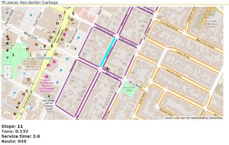
Is it possible to allow the user/client to change the route attribute value in a manner that it changes the original geoJSON and then refresh the web page to see the new changes (lines are symbolized by route number)?

I am a webmapping newbie so pardon any misnomers I am probably making.

I have a geoJSON file that represents garbage cans as lines running along a street (i.e. the line is an aggregated representation of all the cans on that street, so if 1 can is 20 lbs and there are 3 cans on the street, the line feature on that street will have a weight attribute of 60 lbs).

These lines have four attributes: weight, time (seconds per picking up all cans on that street), number of cans on the street, and the route number that services them. These attributes appear in a div at the bottom of the screen when you click/select a given line: enter image description here

Is it possible to allow the user/client to change the route attribute value in a manner that it changes the original geoJSON and then refresh the web page to see the new changes (lines are symbolized by route number)?

Source Link
geoJshaun
  • 1.3k
  • 1
  • 16
  • 34

Possible for client to edit geoJSON on server?

I have a geoJSON file that represents garbage cans as lines running along a street (i.e. the line is an aggregated representation of all the cans on that street, so if 1 can is 20 lbs and there are 3 cans on the street, the line feature on that street will have a weight attribute of 60 lbs).

These lines have four attributes: weight, time (seconds per picking up all cans on that street), number of cans on the street, and the route number that services them. These attributes appear in a div at the bottom of the screen when you click/select a given line: enter image description here

Is it possible to allow the user/client to change the route attribute value in a manner that it changes the original geoJSON and then refresh the web page to see the new changes (lines are symbolized by route number)?