Post Closed as "Duplicate" by PolyGeo
deleted 147 characters in body
Source Link
PolyGeo
  • 65.4k
  • 29
  • 114
  • 345

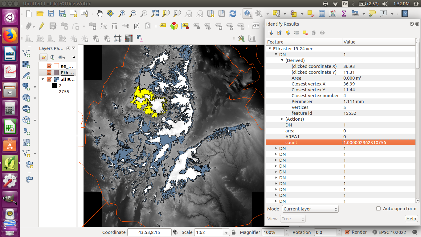
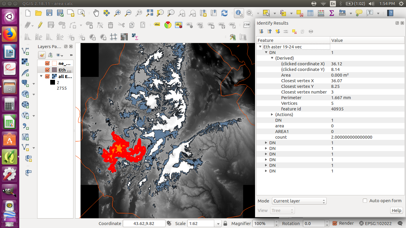
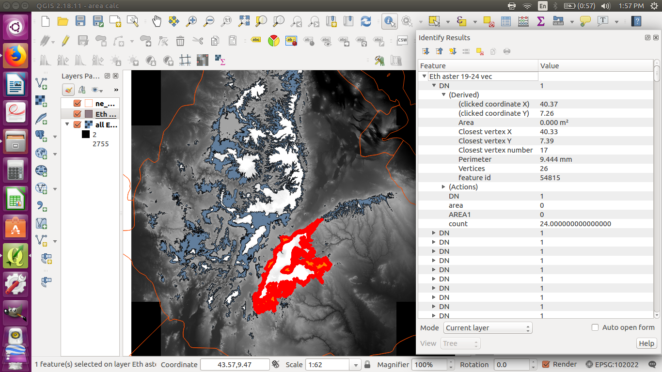
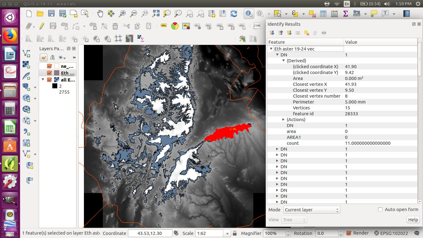
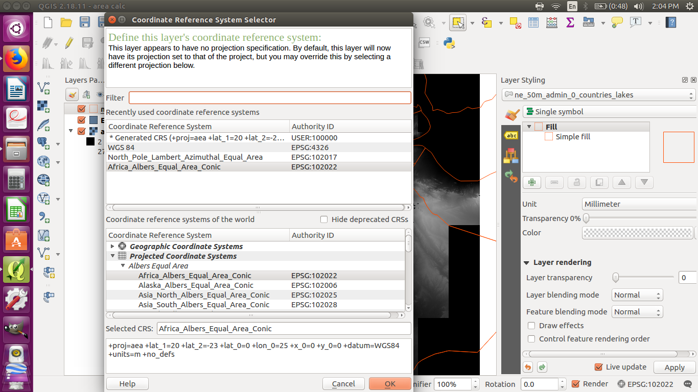
I made a shapefile from a DEM raster of Ethiopia, and I want to find the total area of the shapefile. I have changed the CRS of all files to Africa_Albers_Equal_Area_Conic (ESPG: 102022), and the units are meters. I have tried using the field calculator, but the answers are very small. I have also used the identify features tool, and the answers are the same as the field calculator's.

I also used "count" in the field calculator to get the number of pixels, but these sometimes seem very small too. The pixel size is 0.000277778,-0.000277778, but I don't know what the units are, so I am not sure how to use that to find the area.

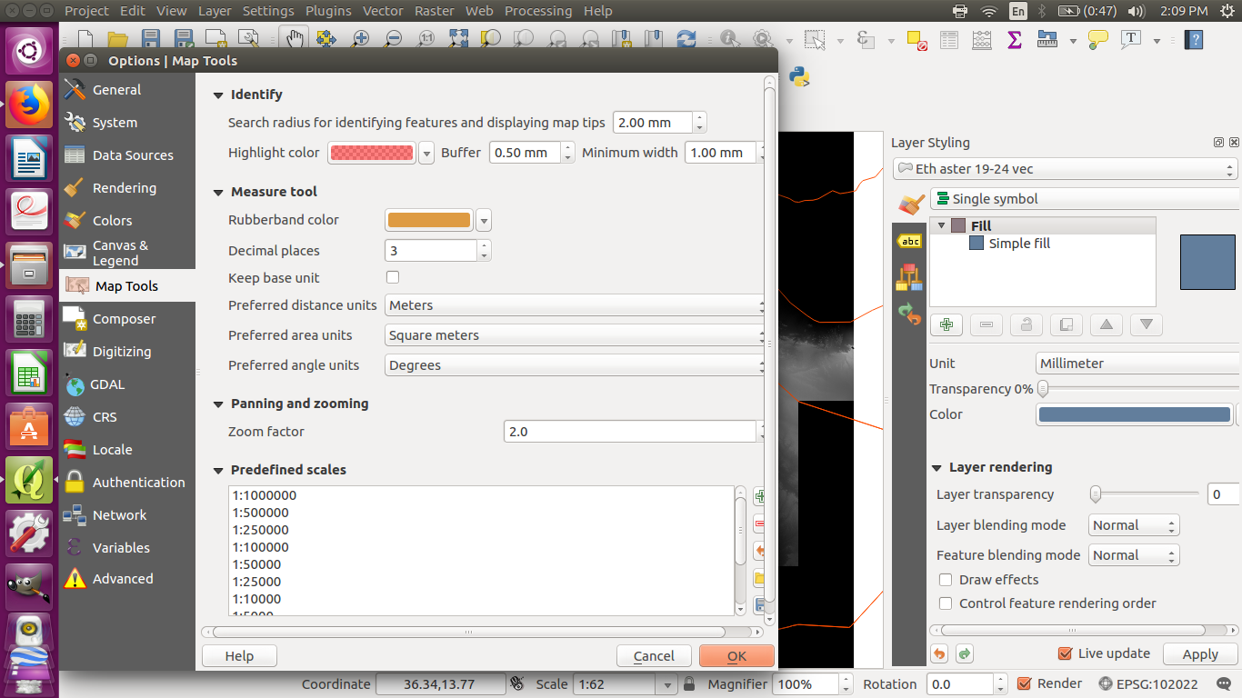
enter image description here enter image description here enter image description here enter image description here enter image description here CRS Units

I tried using the measure area tool where you draw a polygon, but this gave a very small answer too. enter image description here
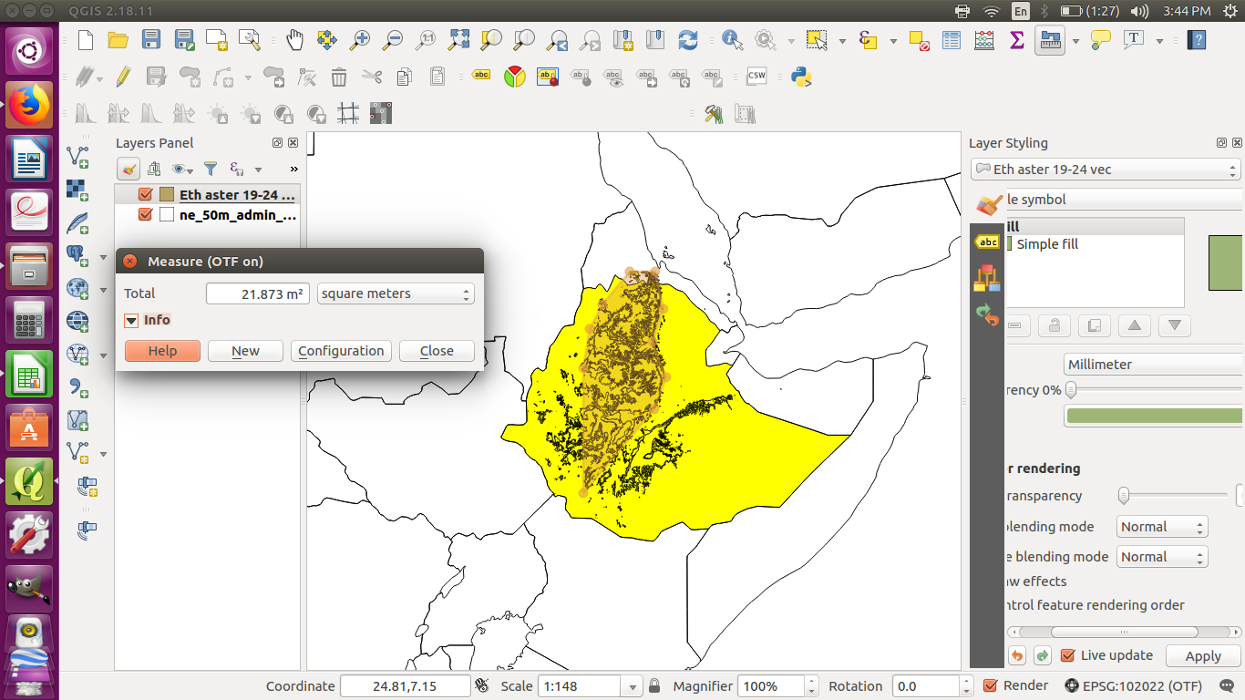
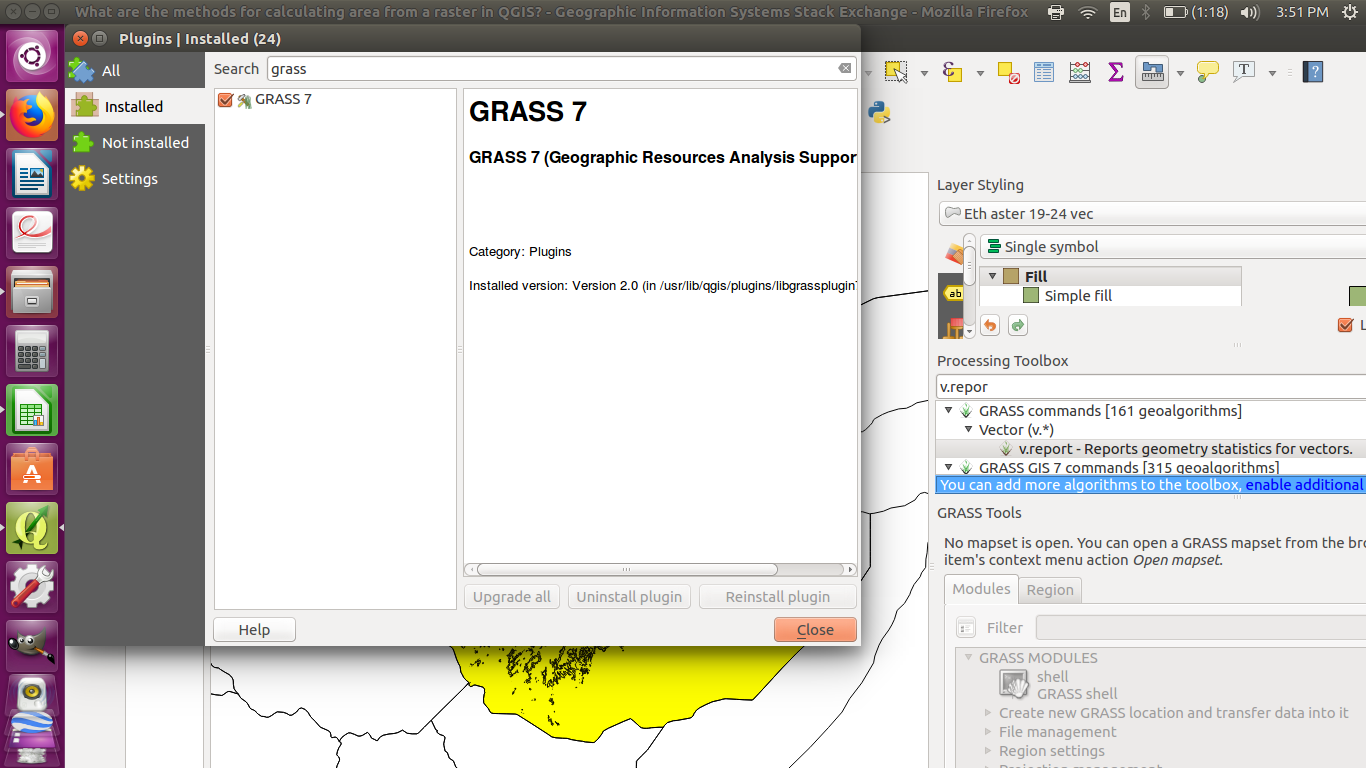
I read there might be a way to do it with GRASS, but I have a problem with my GRASS plugin which I don't understand. enter image description here enter image description here
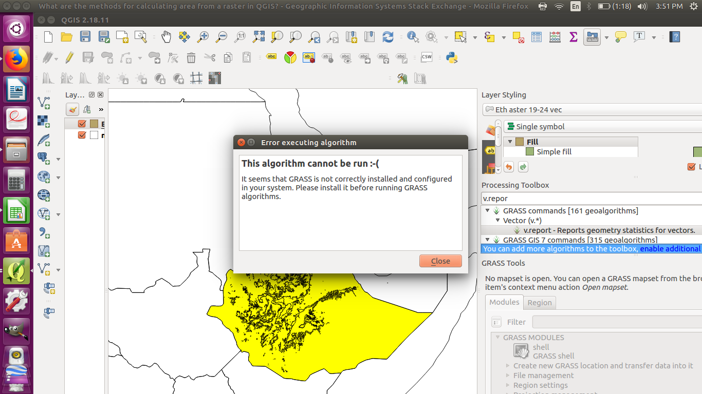
You are welcome to post answers that use Python, but I have no experience with that, so I am looking for a way to do it without Python. Thanks.

I made a shapefile from a DEM raster of Ethiopia, and I want to find the total area of the shapefile. I have changed the CRS of all files to Africa_Albers_Equal_Area_Conic (ESPG: 102022), and the units are meters. I have tried using the field calculator, but the answers are very small. I have also used the identify features tool, and the answers are the same as the field calculator's.

I also used "count" in the field calculator to get the number of pixels, but these sometimes seem very small too. The pixel size is 0.000277778,-0.000277778, but I don't know what the units are, so I am not sure how to use that to find the area.

enter image description here enter image description here enter image description here enter image description here enter image description here CRS Units

I tried using the measure area tool where you draw a polygon, but this gave a very small answer too. enter image description here

I read there might be a way to do it with GRASS, but I have a problem with my GRASS plugin which I don't understand. enter image description here enter image description here
You are welcome to post answers that use Python, but I have no experience with that, so I am looking for a way to do it without Python. Thanks.

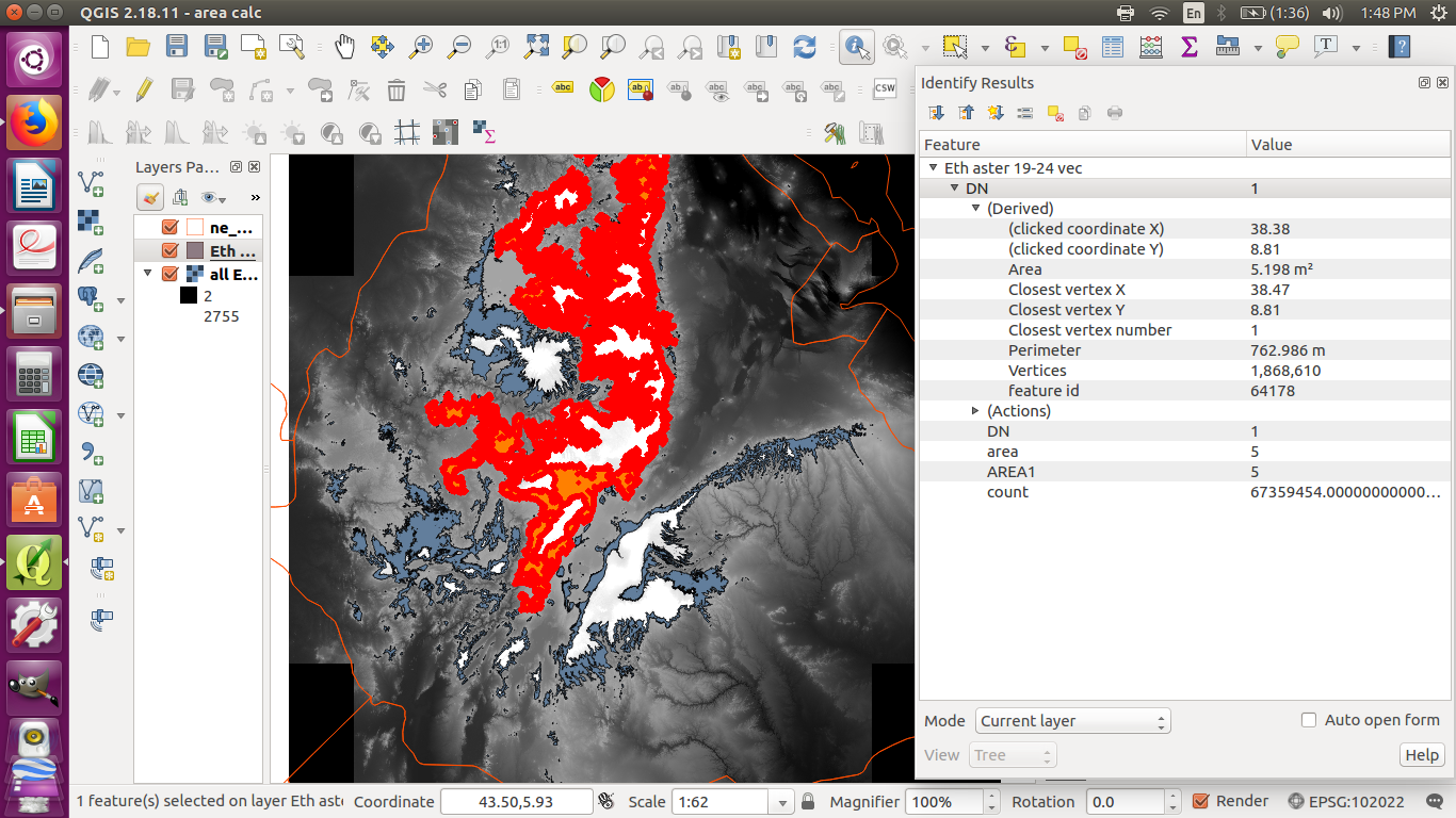
I made a shapefile from a DEM raster of Ethiopia, and I want to find the total area of the shapefile. I have changed the CRS of all files to Africa_Albers_Equal_Area_Conic (ESPG: 102022), and the units are meters. I have tried using the field calculator, but the answers are very small. I have also used the identify features tool, and the answers are the same as the field calculator's.

I also used "count" in the field calculator to get the number of pixels, but these sometimes seem very small too. The pixel size is 0.000277778,-0.000277778, but I don't know what the units are, so I am not sure how to use that to find the area.

enter image description here enter image description here enter image description here enter image description here enter image description here CRS Units

I tried using the measure area tool where you draw a polygon, but this gave a very small answer too. enter image description here

I read there might be a way to do it with GRASS, but I have a problem with my GRASS plugin which I don't understand. enter image description here enter image description here

Source Link
mmmm
  • 241
  • 2
  • 10

Area calc gives odd answers

I made a shapefile from a DEM raster of Ethiopia, and I want to find the total area of the shapefile. I have changed the CRS of all files to Africa_Albers_Equal_Area_Conic (ESPG: 102022), and the units are meters. I have tried using the field calculator, but the answers are very small. I have also used the identify features tool, and the answers are the same as the field calculator's.

I also used "count" in the field calculator to get the number of pixels, but these sometimes seem very small too. The pixel size is 0.000277778,-0.000277778, but I don't know what the units are, so I am not sure how to use that to find the area.

enter image description here enter image description here enter image description here enter image description here enter image description here CRS Units

I tried using the measure area tool where you draw a polygon, but this gave a very small answer too. enter image description here

I read there might be a way to do it with GRASS, but I have a problem with my GRASS plugin which I don't understand. enter image description here enter image description here

You are welcome to post answers that use Python, but I have no experience with that, so I am looking for a way to do it without Python. Thanks.