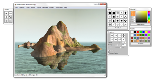
I've found a program that basically does what I asked for.
It's called Earth Sculptor. It has a couple of nice tools for terraforming: raise, lower, level, grab, smooth, erode, push and ramp. It's not GIS aware but takes tga, bmp and png rasters with maximal size of 4097x4097 px.
I shall see if I can edit a real DEM raster and return with more info.

EDIT: I've found that Earth Sculptor isn't particularly suited for manipulating DEM. Mainly because it doesn't support 32-bit float rasters. The best you can work with is 16-bit png.
ArcGIS can only export to unsigned 16-bit png, so it leaves you with integers from 0 to 65535. You can move your elevation data to that range with raster algebra, but one problem still persists. After loading my translated elevation into ES it turned out really flat. It seems that I would have to do some kind histogram stretching to fit my elevation into 0 to 65535 range.
In conclusion. Its a bit to much work to get your data into ES to justify the benefits. The ideal software would have to work with 32-bit float tiffs.
