4

I'm looking for software that can perform local adjustments in DEMs with tools similar to paintbrushes used in graphics editing programs but streamlined to respect geomorphology.

To give you an idea of what I have in mind check out this video of SimCity 4 terraforming mode. I would give a lot to have such a tool in ArcGIS environment.

Any local DEM modification in ArcMAP is a hassle.

Let's say I have a DEM with river bathymetry imprinted in it but there is a river port along that wasn't covered and has the height of the water surface (that's the usual case with LIDAR derived DEMs - water bodies are filled).

The only information about the harbour is the maximal depth. So to transfer this information to my DEM, I erase the entire harbour area (null values), imprint a small raster with maximal depth in the center of the harbour basin and then I fill the remaing null cells with a moving window filter.

The results of this operation are usually sufficient but the whole process is complicated. If only I had a "lower terrain paintbrush" :)

1

2 Answers 2

3

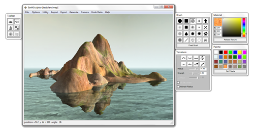
I've found a program that basically does what I asked for.

It's called Earth Sculptor. It has a couple of nice tools for terraforming: raise, lower, level, grab, smooth, erode, push and ramp. It's not GIS aware but takes tga, bmp and png rasters with maximal size of 4097x4097 px.

I shall see if I can edit a real DEM raster and return with more info.

enter image description here

EDIT: I've found that Earth Sculptor isn't particularly suited for manipulating DEM. Mainly because it doesn't support 32-bit float rasters. The best you can work with is 16-bit png.

ArcGIS can only export to unsigned 16-bit png, so it leaves you with integers from 0 to 65535. You can move your elevation data to that range with raster algebra, but one problem still persists. After loading my translated elevation into ES it turned out really flat. It seems that I would have to do some kind histogram stretching to fit my elevation into 0 to 65535 range.

In conclusion. Its a bit to much work to get your data into ES to justify the benefits. The ideal software would have to work with 32-bit float tiffs.

1

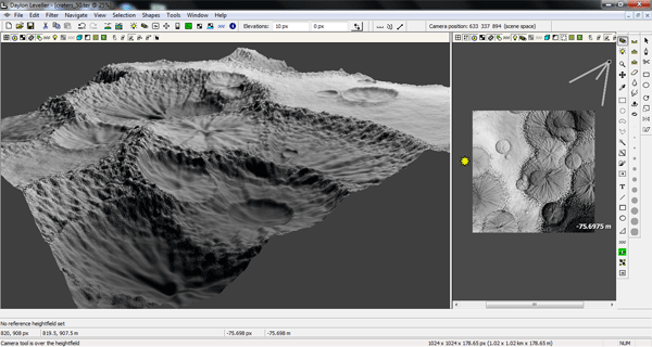
An answer in another thread pointed to a software that seems to be what I'm looking for. It's called Leveller and is made by Canadian company called Daylon Graphics. The software is paid and sadly has no trial version.

enter image description here http://www.daylongraphics.com/products/leveller.php

3
  • Our company bought one licence. It is not perfect - we especially struggled with import and export - not sure anymore if only SAGA grid and/or GeoTIF were somehow working for import/export and not ruining georeferencing but after few trials manageable together with QGIS. The tools within application worked pretty good even with possibility of masking areas loading shapefile etc.
    – Miro
    Commented Jun 12, 2015 at 12:15
  • Miro, so what I understand is that beside import/export issues you are satisfied with it? Can I ask what does your company use it for?
    – pg85
    Commented Jun 16, 2015 at 9:19
  • 1
    I used it few times to create/adjust alluvium beds (geology around creeks/rivers). Generally tools are very good to adjust terrain level - up/down/leveling to height, leveling all above/below value, smooth, smudge... Apart these manual tools with scalable"brush" there are also some filters applicable to whole grid like smooth etc. As I mentioned problems with I/E, here and there crash and with some sizes of "brush" artifacts... It was good enough for what I needed but can't say I was completely happy with it.
    – Miro
    Commented Jun 16, 2015 at 10:46

Your Answer

By clicking “Post Your Answer”, you agree to our terms of service and acknowledge you have read our privacy policy.

Not the answer you're looking for? Browse other questions tagged or ask your own question.