added 403 characters in body
Source Link
Mars
  • 385
  • 2
  • 9

This is not something I have tried before, but my instinct is to "warp" the low resolution raster to the same pixel size as the high resolution image.

This way the higher resolution image will be able to "merge" into the extra pixels created for the low resolution image.

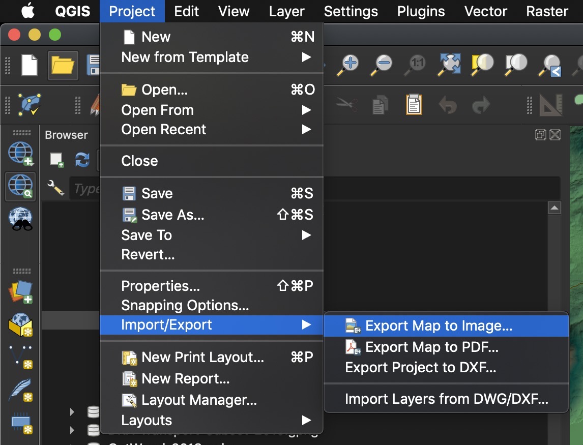
--> You can also try Project > Import/Export > Export Map to Image...

Project > Import/Export > Export Map to Image...

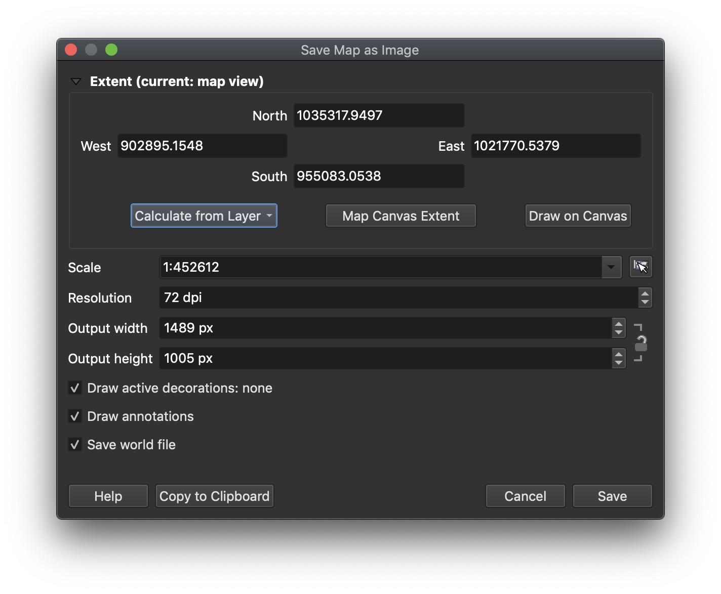
You can use the extent of your largest Orthophoto, and try adjusting the DPI to get the resolution you desire.

enter image description here

This is not something I have tried before, but my instinct is to "warp" the low resolution raster to the same pixel size as the high resolution image.

This way the higher resolution image will be able to "merge" into the extra pixels created for the low resolution image.

This is not something I have tried before, but my instinct is to "warp" the low resolution raster to the same pixel size as the high resolution image.

This way the higher resolution image will be able to "merge" into the extra pixels created for the low resolution image.

--> You can also try Project > Import/Export > Export Map to Image...

Project > Import/Export > Export Map to Image...

You can use the extent of your largest Orthophoto, and try adjusting the DPI to get the resolution you desire.
enter image description here

Removed question from answer
Source Link
PolyGeo
  • 65.4k
  • 29
  • 114
  • 345

This is not something I have tried before, but my instinct is to "warp" the low resolution raster to the same pixel size as the high resolution image.

This way the higher resolution image will be able to "merge" into the extra pixels created for the low resolution image.

Q. Are both Rasters in the same projection or CRS?

This is not something I have tried before, but my instinct is to "warp" the low resolution raster to the same pixel size as the high resolution image.

This way the higher resolution image will be able to "merge" into the extra pixels created for the low resolution image.

Source Link
Mars
  • 385
  • 2
  • 9

This is not something I have tried before, but my instinct is to "warp" the low resolution raster to the same pixel size as the high resolution image.

This way the higher resolution image will be able to "merge" into the extra pixels created for the low resolution image.

Q. Are both Rasters in the same projection or CRS?