Working on ArcGIS 10.7
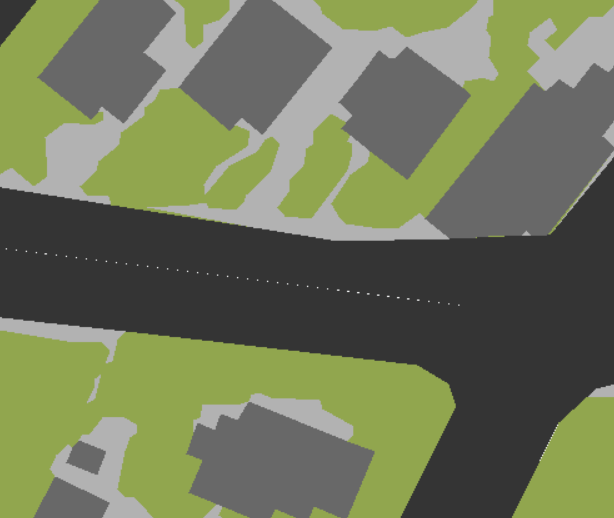
I have a layer in which, when looking from a certain distance, some aligned white dots appear between two entities (in the image below, the black entity - a road - is formed by 2 parallel geometries, one for each lane):
When I zoom in, however, the white dots disappear. This makes me wonder if the dots are caused by topological errors or just by the software's plotting resolution. I have run "repair geometries" and the points are still there. The layer represented and the data frame both have the same CRS.
What would be an explanation of this / a way to check what it can be causing it?


