Notice removed Draw attention by zabop
Bounty Ended with user30184's answer chosen by zabop
Tweeted twitter.com/StackGIS/status/1554799262109687808
edited tags
Link
zabop
  • 2.7k
  • 14
  • 41
added 1457 characters in body; edited title
Source Link
zabop
  • 2.7k
  • 14
  • 41

Accessing Spanish cadastral data through WFS andvia QGIS

Problem

I would like to have access to cadastral data (= land parcels) of Spain in vector format, so I can do further processing on them and put them into a database. I tried to do this multiple ways, none successful so far. My attempts are below.


WFS attempt

There is the Servicios INSPIRE de Cartografía Catastral webpage, listing ways to access Spanish cadastral data.

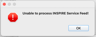
The listed WFS link is: http://ovc.catastro.meh.es/INSPIRE/wfsCP.aspx?. However, when add this source to QGIS as a WFS layer, I get this error message:

enter image description here

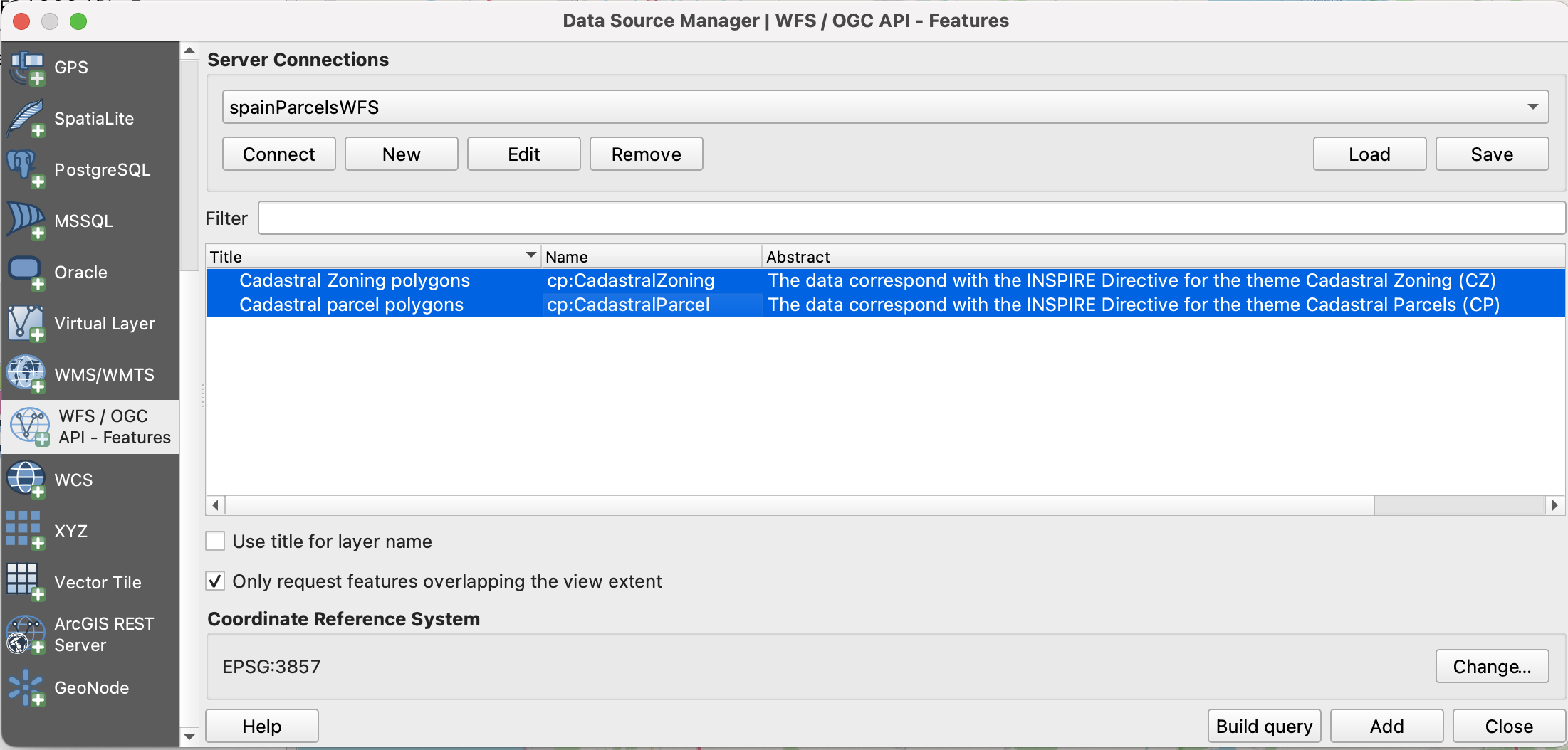
There is also the Descripción del servicio link. Using that, I figured I might need to use this link: http://ovc.catastro.meh.es/INSPIRE/wfsCP.aspx?Version=2.0.0. I can add this to QGIS via Layer -> Add Layer -> Add WFS Layer..., and seem to be able to connect to the service:

enter image description here

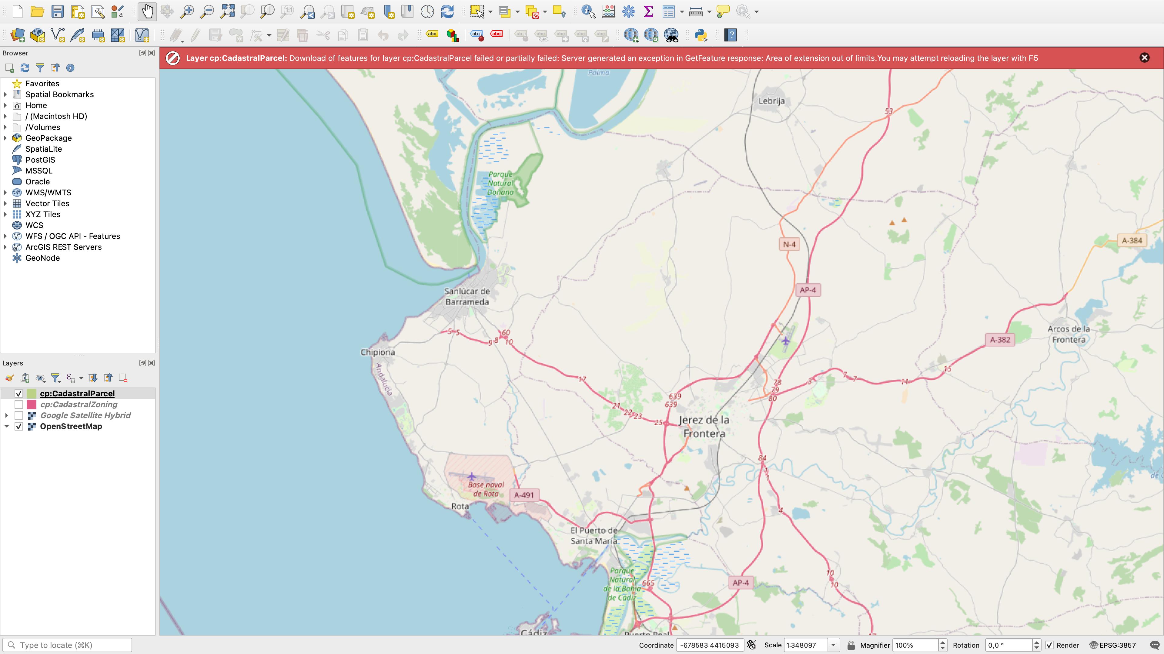
I Add, but then if I zoom to Spain in canvas, I get:

enter image description here

ie the error message:

Layer cp:CadastralParcel: Download of features for layer cp:CadastralParcel failed or partially failed: Server generated an exception in GetFeature response: Area of extension out of limits. You may attempt reloading the layer with F5


ATOM attempt

I downloaded the INSPIRE Atom Client Plugin. Installed it using steps from this answer. Then, using https://www.catastro.minhap.es/webinspire/index_eng.html I tried to add both of these links:

enter image description here

ie

as a layer to QGIS via Web -> INSPIRE Atom Client -> INSPIRE Atom Client, insert link, then Get Metadata (Atom).

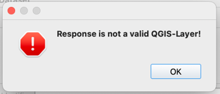
Using the first link I get the error:

enter image description here

while the second one leads to:

enter image description here


Question

How can I solve the issues above or access Spain's land parcel data otherwise?

My main aim is to be able to download parcel data in vector format (that's why I'm trying the WFS and not the WMS service).

Accessing Spanish cadastral data through WFS and QGIS

There is the Servicios INSPIRE de Cartografía Catastral webpage, listing ways to access Spanish cadastral data.

The listed WFS link is: http://ovc.catastro.meh.es/INSPIRE/wfsCP.aspx?. However, when add this source to QGIS as a WFS layer, I get this error message:

enter image description here

There is also the Descripción del servicio link. Using that, I figured I might need to use this link: http://ovc.catastro.meh.es/INSPIRE/wfsCP.aspx?Version=2.0.0. I can add this to QGIS via Layer -> Add Layer -> Add WFS Layer..., and seem to be able to connect to the service:

enter image description here

I Add, but then if I zoom to Spain in canvas, I get:

enter image description here

ie the error message:

Layer cp:CadastralParcel: Download of features for layer cp:CadastralParcel failed or partially failed: Server generated an exception in GetFeature response: Area of extension out of limits. You may attempt reloading the layer with F5

How can I solve the issues above or access Spain's land parcel data otherwise?

My main aim is to be able to download parcel data in vector format (that's why I'm trying the WFS and not the WMS service).
Accessing Spanish cadastral data via QGIS

Problem

I would like to have access to cadastral data (= land parcels) of Spain in vector format, so I can do further processing on them and put them into a database. I tried to do this multiple ways, none successful so far. My attempts are below.


WFS attempt

There is the Servicios INSPIRE de Cartografía Catastral webpage, listing ways to access Spanish cadastral data.

The listed WFS link is: http://ovc.catastro.meh.es/INSPIRE/wfsCP.aspx?. However, when add this source to QGIS as a WFS layer, I get this error message:

enter image description here

There is also the Descripción del servicio link. Using that, I figured I might need to use this link: http://ovc.catastro.meh.es/INSPIRE/wfsCP.aspx?Version=2.0.0. I can add this to QGIS via Layer -> Add Layer -> Add WFS Layer..., and seem to be able to connect to the service:

enter image description here

I Add, but then if I zoom to Spain in canvas, I get:

enter image description here

ie the error message:

Layer cp:CadastralParcel: Download of features for layer cp:CadastralParcel failed or partially failed: Server generated an exception in GetFeature response: Area of extension out of limits. You may attempt reloading the layer with F5


ATOM attempt

I downloaded the INSPIRE Atom Client Plugin. Installed it using steps from this answer. Then, using https://www.catastro.minhap.es/webinspire/index_eng.html I tried to add both of these links:

enter image description here

ie

as a layer to QGIS via Web -> INSPIRE Atom Client -> INSPIRE Atom Client, insert link, then Get Metadata (Atom).

Using the first link I get the error:

enter image description here

while the second one leads to:

enter image description here


Question

How can I solve the issues above or access Spain's land parcel data otherwise?

My main aim is to be able to download parcel data in vector format (that's why I'm trying the WFS and not the WMS service).
Notice added Draw attention by zabop
Bounty Started worth 200 reputation by zabop
Source Link
zabop
  • 2.7k
  • 14
  • 41

Accessing Spanish cadastral data through WFS and QGIS

There is the Servicios INSPIRE de Cartografía Catastral webpage, listing ways to access Spanish cadastral data.

The listed WFS link is: http://ovc.catastro.meh.es/INSPIRE/wfsCP.aspx?. However, when add this source to QGIS as a WFS layer, I get this error message:

enter image description here

There is also the Descripción del servicio link. Using that, I figured I might need to use this link: http://ovc.catastro.meh.es/INSPIRE/wfsCP.aspx?Version=2.0.0. I can add this to QGIS via Layer -> Add Layer -> Add WFS Layer..., and seem to be able to connect to the service:

enter image description here

I Add, but then if I zoom to Spain in canvas, I get:

enter image description here

ie the error message:

Layer cp:CadastralParcel: Download of features for layer cp:CadastralParcel failed or partially failed: Server generated an exception in GetFeature response: Area of extension out of limits. You may attempt reloading the layer with F5

How can I solve the issues above or access Spain's land parcel data otherwise?

My main aim is to be able to download parcel data in vector format (that's why I'm trying the WFS and not the WMS service).