I use the classical method (Add vector layer, directory, gdb database)
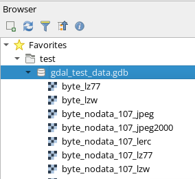
That's the classic way to add vector data. If you want to add raster data, normally you could use the Add raster layer method, but this doesn't work for FGDB rasters. Instead, either drag rasterFGDB rasters into your map from the Browser pane andor use the Layer menu -> Data Source Manager -> Browser tab:
If that doesn't work, re-check your GDAL version in QGIS, just in case the GDAL version QGIS is using is different to the GDAL/OGR 3.8.4 you note in your question as raster support was only added to the GDAL OpenFileGDB driver in GDAL version 3.7.
To check:
So for the above QGIS example, only the 2nd QGIS install would be able to read FGDB raster data.


