Geographic data that describes a location can be geocoded and placed on a map very easily by using Google Fusion Tables which you can find under Google Drive.
Here is an example I made to show you how to add a list of addresses on Google Map.
Step 1:
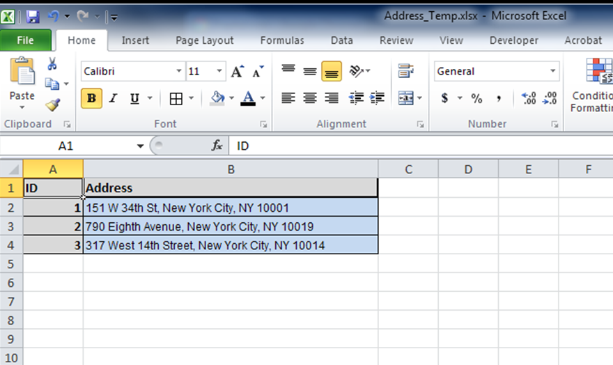
Organize your address information into a excel or CSV table similar to this one below.
Step 2:
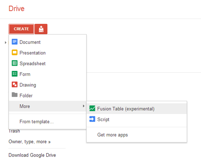
Open your Google Drive and create a new fusion table. Select the excel table you generated from Step 1 as your input table.
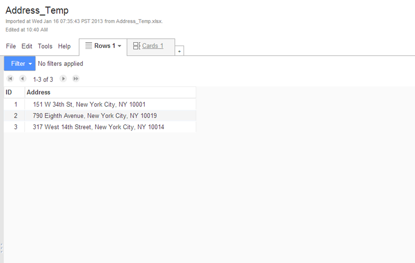
You will have a new Fusion table looks like this one below:
Step 3:
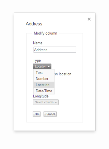
Click the column name "Address" and select the first option which is "Change"; then change the type of your address column to "Location" and click OK.
Step 4:
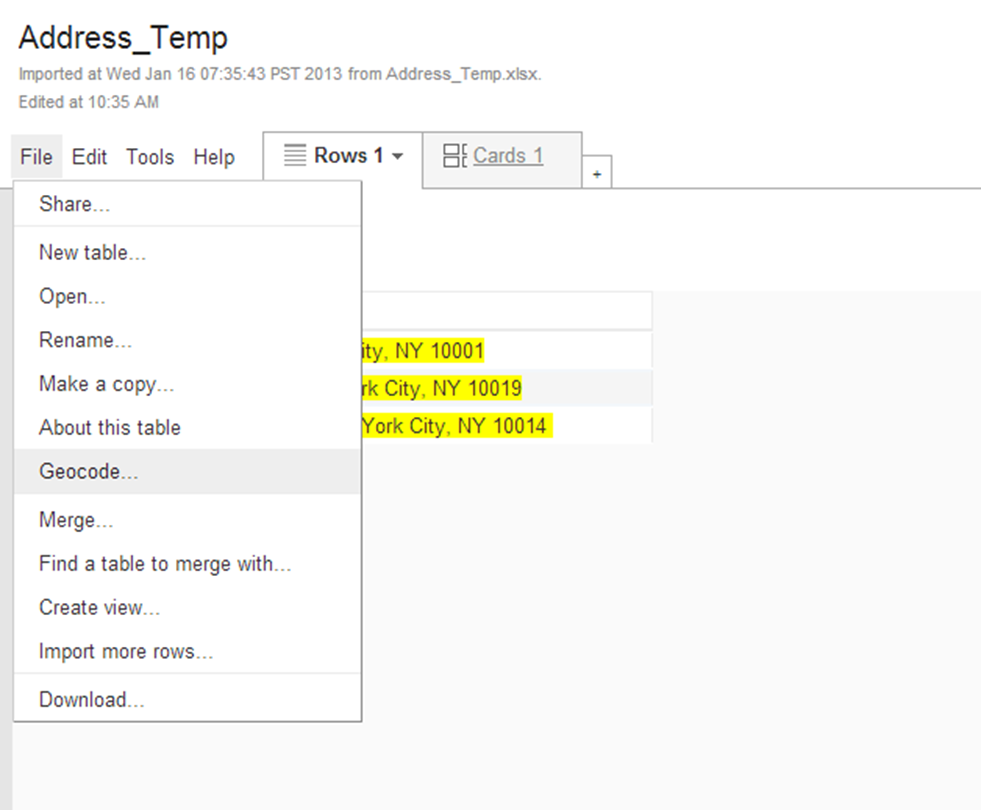
After that, go to file and click the option "Geocode" to map these addresses on Google map.
Step 5:
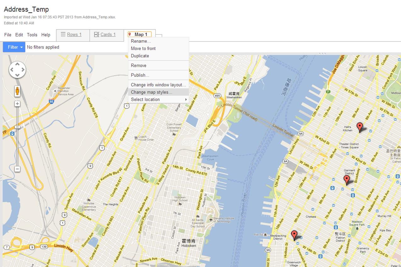
Click OK when the geocoding is done and you should have all of your addresses mapped. You will be able to customize the symbol and style of your results.
I believe this will give you what you want, and here is a documentation provided by Google about how to geocode addresses.
Hope it is helpful for you.
Jinnan
