Commonmark migration
Source Link

I am now in a project using a taxi GPS data(latitude and longitude ) to locate the road segment it is being on.I have the road map data. So, I wonder if I can use arcgis server to get the road segment information according to the GPS data?I wander if there is an java api for me to call easily? for Example, I have the latitude 16.34211,longitude 4.0102,I call the function getRoadSegment(16.34211,4.0102),the function then return the road segment (maybe the startpoint(x1,y1) and the endpoint(x2,y2)) this point is in.!![enter image description here][1]enter image description here
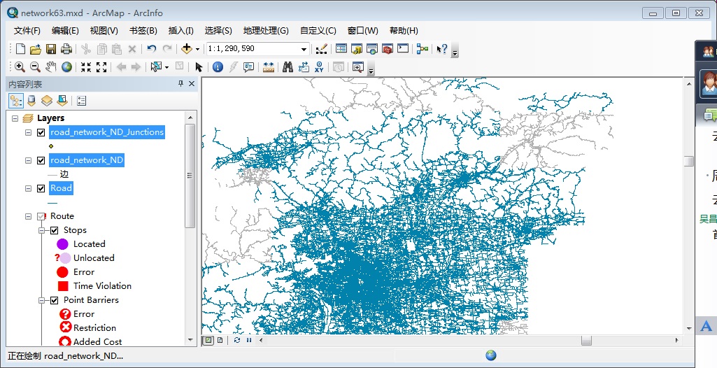
This picture is when I import mxc data file into ArcGIS. [1]: https://i.sstatic.net/kNfcn.jpg

I am now in a project using a taxi GPS data(latitude and longitude ) to locate the road segment it is being on.I have the road map data. So, I wonder if I can use arcgis server to get the road segment information according to the GPS data?I wander if there is an java api for me to call easily? for Example, I have the latitude 16.34211,longitude 4.0102,I call the function getRoadSegment(16.34211,4.0102),the function then return the road segment (maybe the startpoint(x1,y1) and the endpoint(x2,y2)) this point is in.!![enter image description here][1]

This picture is when I import mxc data file into ArcGIS. [1]: https://i.sstatic.net/kNfcn.jpg

I am now in a project using a taxi GPS data(latitude and longitude ) to locate the road segment it is being on.I have the road map data. So, I wonder if I can use arcgis server to get the road segment information according to the GPS data?I wander if there is an java api for me to call easily? for Example, I have the latitude 16.34211,longitude 4.0102,I call the function getRoadSegment(16.34211,4.0102),the function then return the road segment (maybe the startpoint(x1,y1) and the endpoint(x2,y2)) this point is in.!enter image description here

This picture is when I import mxc data file into ArcGIS.

edited tags
Link
PolyGeo
  • 65.4k
  • 29
  • 114
  • 345
typos
Source Link
Mapperz
  • 50.2k
  • 9
  • 75
  • 133

How can I use arcgis server to help me find a streatstreet according to Latitude and longitude?

I am now in a project using a taxi GPS data(latitude and longitude ) to locate the road segment it is being on.I have the road map data.So So,I wander I wonder if I can use arcgis server to get the road segment infomationinformation according to the GPS data?I wander if there is an java api for me to call easily  ?for for Example  ,I I have the latitude 16.34211,longitude 4.0102,I call the function getRoadSegment(16.34211,4.0102),the function then return the road setmentsegment (maybe the startpoint(x1,y1) and the endpoint(x2,y2)) this point is in.!![enter image description here][1]

This picture is when I import mxc data file into arcGisArcGIS. [1]: https://i.sstatic.net/kNfcn.jpg

How can I use arcgis server to help me find a streat according to Latitude and longitude?

I am now in a project using a taxi GPS data(latitude and longitude ) to locate the road segment it is being on.I have the road map data.So ,I wander if I can use arcgis server to get the road segment infomation according to the GPS data?I wander if there is an java api for me to call easily  ?for Example  ,I have the latitude 16.34211,longitude 4.0102,I call the function getRoadSegment(16.34211,4.0102),the function then return the road setment(maybe the startpoint(x1,y1) and the endpoint(x2,y2)) this point is in.!![enter image description here][1]

This picture is when I import mxc data file into arcGis. [1]: https://i.sstatic.net/kNfcn.jpg

How can I use arcgis server to help me find a street according to Latitude and longitude?

I am now in a project using a taxi GPS data(latitude and longitude ) to locate the road segment it is being on.I have the road map data. So, I wonder if I can use arcgis server to get the road segment information according to the GPS data?I wander if there is an java api for me to call easily? for Example, I have the latitude 16.34211,longitude 4.0102,I call the function getRoadSegment(16.34211,4.0102),the function then return the road segment (maybe the startpoint(x1,y1) and the endpoint(x2,y2)) this point is in.!![enter image description here][1]

This picture is when I import mxc data file into ArcGIS. [1]: https://i.sstatic.net/kNfcn.jpg

Source Link
Loading