2

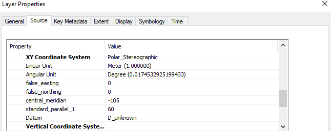
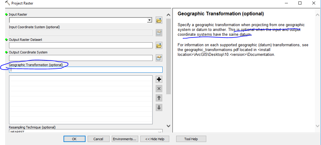
enter image description hereI am new to GIS. I had a grib format data file and it's coordinate system shown below. I want to project it to WGS84, however, the datum of original file is unknown. I know I need to provide the datum info while projecting.

How can I solve this using ArcGIS Desktop?

enter image description here

4
  • You have to declare the output datum. There is a WGS 84 datum you can use. See this answer for more info on projections and datums
    – nyquist
    Commented Sep 17, 2018 at 18:54
  • 2
    You can reproject it, but it might be dozens of kilometers in error. In general, without other information to attempt proper registration, unknown datum means unusable data.
    – Vince
    Commented Sep 17, 2018 at 18:55
  • 1
    If you add the raster to ArcMap and look at the data frame properties, coordinate system tab, can you get the spheroid (ellipsoid) information? That may or may not help us give you an answer.
    – mkennedy
    Commented Sep 17, 2018 at 18:57
  • 2
    Also where did you get the data / who's the data provider? Do they talk about coordinate systems at all?
    – mkennedy
    Commented Sep 17, 2018 at 18:58

0

Your Answer

By clicking “Post Your Answer”, you agree to our terms of service and acknowledge you have read our privacy policy.