I am a journalist.
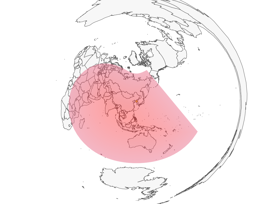
My goal: A globe that shows the range ok North Koreas ICBMs - the azimuthal equidistant projection centered on NK.
My steps so far:
- Created Standard QGIS project (EPSG:4326)
- Imported a world shapefile (EPSG:4326). The center of the shapefile is in Greenwhich.
- Imported a CSV with the lat/long of Pyongyang
- Used MMQGIS to create a buffer (13,000 km)
Created a Custom CRS with these details:
+proj=ortho +lat_0=39.03385 +lon_0=125.755504 +x_0=0 +y_0=0 +a=6371000
+b=6371000 +units=m +no_defs
Didn't look so nice (and since the US was not visible it was useless for me)
Created a different Custom CRS with these details:
+proj=aeqd +lat_0=39.03385 +lon_0=125.755504 +x_0=0 +y_0=0 +a=6371000 +b=6371000 +units=m +no_defs +proj=aeqd +R=6371000 +lat_0=39 +lon_0=125
My problem:
Being not a GIS pro, I would be quite proud of myself - if there wasn't a part of the buffer (=range) missing - exactly at the line where my original shapefile "ended."
For the record, I checked posts like: - Map Range of Airplanes - Manipulating Azimuthal Equidistant Projections in QGIS - How do I project a Azimuthal Equidistant global map into a circle in QGIS?
I also tried to first create a new shapefile centered on the pacific using QGIS display world country shape files centered on pacific ocean using Robinson, Miller Cylindrical or other projection but that also did not work.


+proj=aeqd +lat_0=39.03385 +lon_0=125.755504 +x_0=0 +y_0=0 +a=6371000 +b=6371000 +units=m +no_defsshould work fine