In Google Maps, why are electric power lines so highly visible? I can find them every place in the United States that has above-ground power.
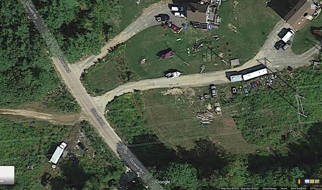
For example, in the Google Maps image below, the high voltage lines are clearly visible. And, above the white boat and trailer near the center of the image, the residential (grid/mains) power lines are also visible.
In my area of the U.S., I estimate that high voltage lines are about 1.5" (4cm) in diameter, and residential power lines to houses are about 0.5" (1.25cm) in diameter.
The width of both lines is surely less than the resolution of the satellite images, so why are they still highly visible?
Edit: Good observation by user30184 that an object that is sufficiently long, sufficiently uniform in color, and with sufficient contrast to its background can be visible well below camera resolution.
The same picture above, but zoomed back so far that vehicles are ambiguous, the power lines are still visible in the right of way for the high voltage lines.


