For my project I need to bring ECW and eww files into QGIS (3.10 Coruna). The aerial pictures of the ECW files give no problems and are well georeferenced. However, I cannot open the EWW raster files in QGIS, which indicate which areas of the ecw files are treated. The error I get is: "Invalid Layer: GDAL provider Cannot open GDAL dataset C". Is there something I can do to fix this or another program I can use? I just need to see which parts are treated, no further processing or calculations will be required. I tried ERDAS ER mapper and IAR EW for arm, but the first one didn't work because of issues with a license and the latter gave problems as well.
1 Answer
- Reinstall QGIS with the OSGeo4W installer.
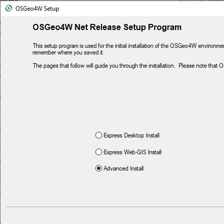
- Select
Advanced Install
- Click next until you get to package selection.
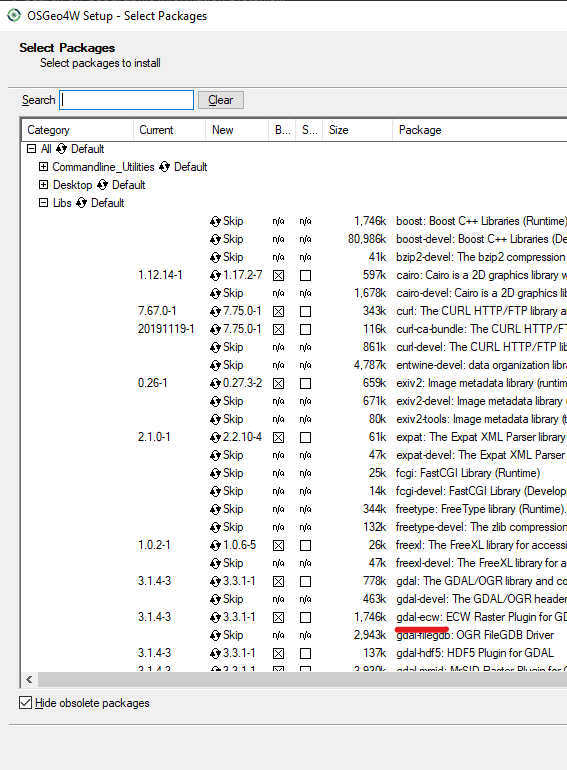
- Expand
Libsand enablegdal-ecw
- Continue to approve the licences, note that it only enables reading ECW, not writing.
- Finish the install and open your files in QGIS.
-
1This works for Windows. For Linux see gis.stackexchange.com/questions/313294/…– AndreJCommented Aug 28, 2021 at 18:26


