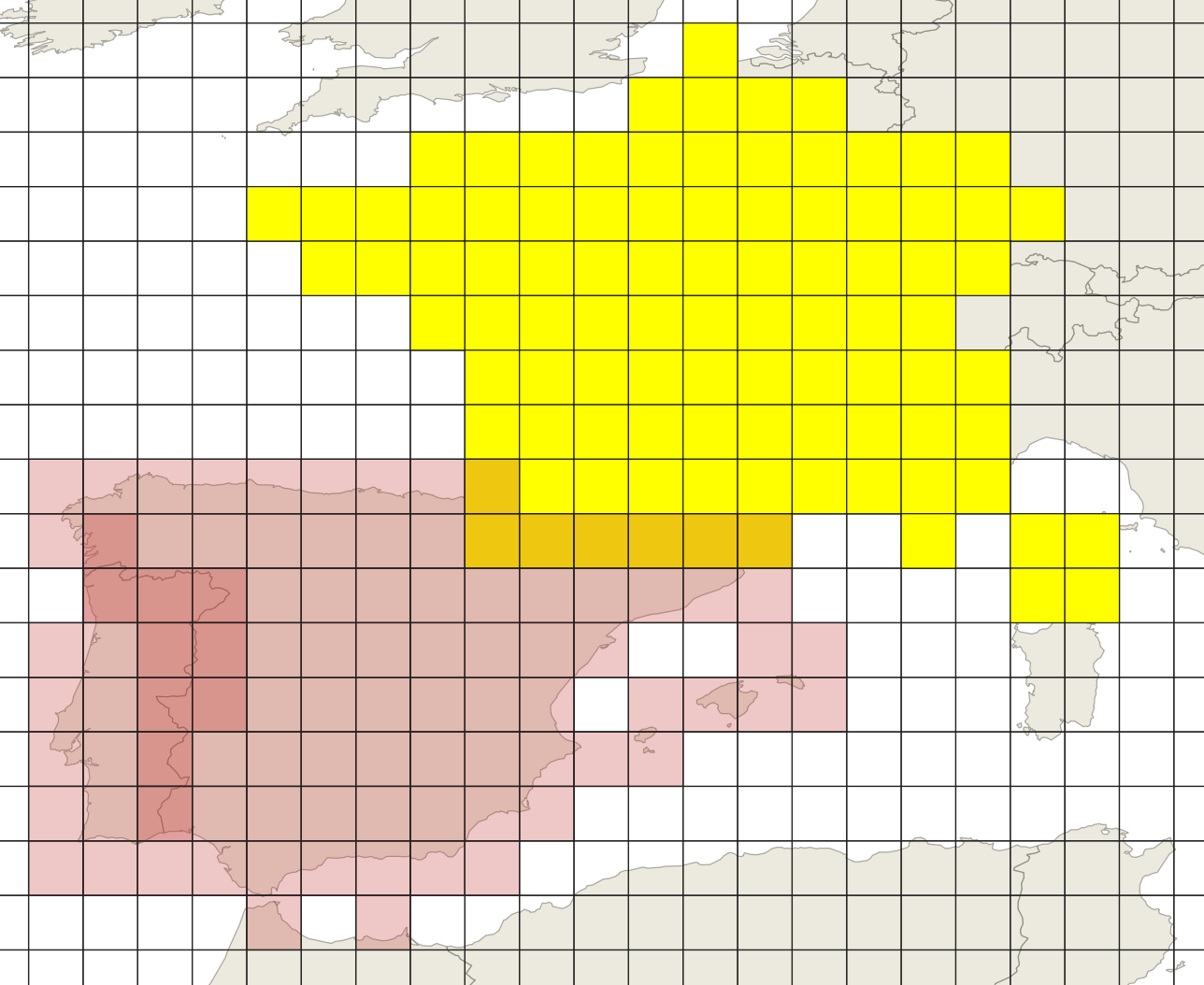
In QGIS I have the data for all the continents except Antarctica. Now I want to create a grid of size 1km * 1km for each country however the problem I am running into is that if I take two neighbouring countries the grids don't align properly as shown in the image below. Both grids and polygons follow the same CRS i.e. EPSG 4326 - WGS 84
I want to generate the grids in a way that it aligns with the other grids. I am complete beginner when it comes to GIS. I will get rid of the overlapping rectangles later, but I want these lines to align so that when shown on a map, it must look like one grid and not a collection of grids. Any guidance or tips?
Edit 1: I want to generate the whole data for world in the form of grids but I am unable to do so in one go as it always crashes after 2 - 3 days of continuous processing with only 6 -8 % progress. Any suggestions that can help me accomplish that will also be very helpful if this country by country route is too complicated.


P[X: -12550035.7, Y: 3798621.8](inEPSG:3857, which you should not use) and a grid cell edge lengthCL=1000 [m], the PointP_C[X: Floor(P.X / CL) * CL, Y: Floor(P.Y / CL) * CL]would be the bottom left corner of the grid cell pointPfalls into. No need to check 100M Polygons for that...