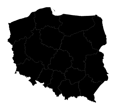
I'm trying to convert official boundaries of administrative regions of Poland from official governmental site (codgik.gov.pl). I want to use those data because they are official ones, and set contains additional levels of borders of that I cannot find in other data sets (such as Natural Earth).
I use approach similar to How to create a GeoJSON that works with D3?. However when I'm trying to use conversion ogr2ogr and plot the results using d3.js I fail. Data seems to be incorrectly translated giving essentially gibberish.
The same approach worked just fine w Natural Earth shapefiles.
By playing around with SVG (deleting paths) I can see that path overlaps and hugely and result in just black square.
Java GeoTools [quickstart tutorial] shows this shapefile without any problem, so I'm guessing mine conversions are off.
Shapefile set is available here (5.5MB)
JavaScript code:
d3.json("wojeowdztwa.json", function(error, map) {
  if (error) return console.error(error);

var projection = d3.geo.mercator()
//    .center([171677, 133223])
//    .scale(69)
    .translate([width / 2, height / 2]);

  var path = d3.geo.path()
    .projection(projection);

svg.append("g").attr("id", "polska")
    .selectAll("path")
      .data(map.features)
      .enter()
        .append("path")
        .attr("id", function(d) { return d.id; })
          .attr("d", path)
          .attr("class", "wojewodztwo");
Content of .PRJ file:
PROJCS["ETRS89 / Poland CS92",
  GEOGCS["ETRS89",
    DATUM["European Terrestrial Reference System 1989",
      SPHEROID["GRS 1980", 6378137.0, 298.257222101],
      TOWGS84[0,0,0]
    ],
    PRIMEM["Greenwich", 0.0],
    UNIT["Decimal Degree", 0.017453292519943295]
  ],
  PROJECTION["Transverse_Mercator"],
  PARAMETER["latitude_of_origin", 0.0],
  PARAMETER["central_meridian", 18.999999999999982],
  PARAMETER["scale_factor", 0.9993],
  PARAMETER["false_easting", 500000.0],
  PARAMETER["false_northing", -5300000.0],
  UNIT["Meter", 1.0],
  AUTHORITY["EPSG", 2180]
]
I'm very new to cartography.


ogr2ogr -f GeoJSON -s_srs epsg:2180 -t_srs epsg:4326 output.json input.shp?