1

I'm trying to update a non-georeferenced table (Table A) to make it georeferenced/mappable. I'm trying to do this using a common set of data also found in a georeferenced table (Table B).

So both tables have one column which contains the same information. This information is a list of sites/polygons.

Table B has one row for each site while Table A has many rows for each site.

I need to make Table A's list of sites georeferenced or add a georeferenced column. For example, if row 1 in Table A contains the site "X" ID then assign that row to polygon "X" in the Map Window.

1
  • 1
    Welcome to GIS SE! As a new user please take the tour to learn about our focused Q&A format.
    – Midavalo
    Commented Apr 10, 2017 at 15:57

1 Answer 1

1

You can do this by joining the two tables.

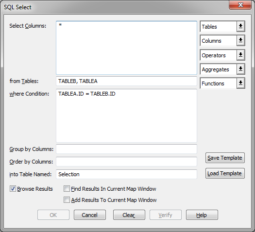
Go to TABLE, SQL Select.

In the dialog select the two tables using the Tables dropdown list. Make sure the two table names are put into the from Tables field.

Now position the cursor in the where Condition field. Select the first ID column from the Column dropdown. Type an = or select it from the Operators dropdown and then select the ID column from the other table.

In the Select Columns field, you can either leave the * or select only some of the columns.

enter image description here

Now save the resulting query as a new table. You should when you open this copy see that each record have been assigned a polygon.

You might also want to check if your resulting table holds all the records from TABLEA.

Your Answer

By clicking “Post Your Answer”, you agree to our terms of service and acknowledge you have read our privacy policy.

Not the answer you're looking for? Browse other questions tagged or ask your own question.