2

Is it possible to select the geographic transformation that is used when reprojecting the layers in QGIS?

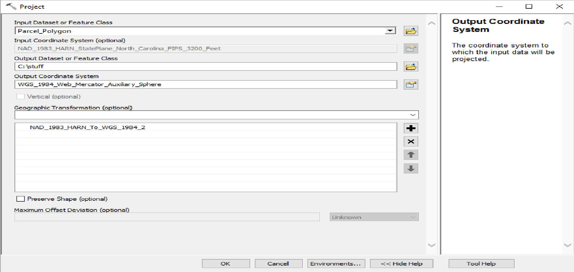
It seems like ESRI defaults to EPSG 1900 when reprojecting the layer from NAD 83(HARN) to WGS 84 (which is weird considering EPSG 1901 supersedes it)

https://epsg.io/1900

ESRI Projection Tool

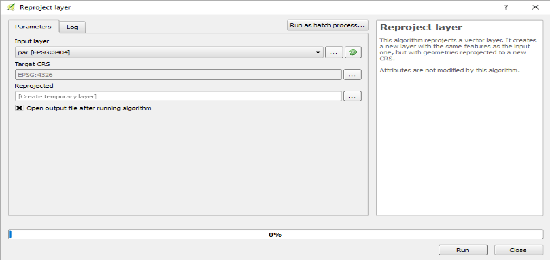
Meanwhile, QGIS seems to default to EPSG 1580 when reprojecting the layer from NAD 83(HARN) to WGS 84 and does not give the option to change it.

https://epsg.io/1580

QGIS projection tool

I believe this might have something to deal with selecting the geographic transformation in QGIS:

+towgs84=0,0,0,0,0,0,0

And I believe that this stack exchange question is related to my issue: Converting NAD 83 to WGS 84 in PostGIS

1 Answer 1

2

If accuracy of +/- 1 meter is not good enough then you can configure a new custom projection.

Follow the QGIS documentation from

http://docs.qgis.org/2.18/en/docs/user_manual/working_with_projections/working_with_projections.html#custom-coordinate-reference-system

The proj parameters should probably be as in the answer Converting NAD 83 to WGS 84 in PostGIS
Take the definition that QGIS is using as a template

# NAD83(HARN) / North Carolina (ftUS)
<3404> +proj=lcc +lat_1=36.16666666666666 +lat_2=34.33333333333334 +lat_0=33.75 +lon_0=-79 +x_0=609601.2192024384 +y_0=0 +ellps=GRS80 +towgs84=0,0,0,0,0,0,0 +units=us-ft +no_defs  <>

Insert the better know +towgs84 parameters

proj=lcc +lat_1=36.16666666666666 +lat_2=34.33333333333334 +lat_0=33.75 +lon_0=-79 +x_0=609601.2192024384 +y_0=0 +ellps=GRS80 +towgs84=-0.99343,-1.90331,-0.52655,0.02591467,0.00942645,0.01159935,0.00171504 +units=us-ft +no_defs  <>

I can see different parameter values in http://www.georepository.com/transformation_1901/NAD83-HARN-to-WGS-84-3.html but unfortunately I can't say if they are better or not than those given by @mkennedy.

1
  • I see. There isn't a super simple way to just change the geographic transformation used to reproject the data. The geographic transformation values are built inside of the coordinate reference system. I wish there was an easier way to handle geographic transformations in QGIS. If the user uses data projected in the same EPSG code but they were derived using different geographic transformations, the data will not align properly. I wonder if it is possible to update the EPSG codes to reflect either industry standards (ESRI defaults) or a more accurate representation of region they are in?
    – Tater
    Commented Jun 10, 2017 at 0:23

Your Answer

By clicking “Post Your Answer”, you agree to our terms of service and acknowledge you have read our privacy policy.

Not the answer you're looking for? Browse other questions tagged or ask your own question.