When publishing ArcGIS Python ToolBox, it still uses the Desktop Output folder.
The code below is coming from the toolbox.
class LandSimilarity(TargetingTool):
    def __init__(self):
        """Define the tool (tool name is the name of the class)."""
        self.label = "Land Similarity"
        self.description = ""
        self.canRunInBackground = False
        self.parameters = [
            parameter("Input raster", "in_raster", "Raster Layer",
                      multiValue=True),
            parameter("Input point layer", "in_point", "Feature Layer"),
            parameter("Output extent", "out_extent", "Feature Layer",
                      parameterType='Optional'),
            parameter("R executable", "r_exe", "File"),
            parameter("Output Mahalanobis raster", "out_raster_mnobis",
                      'Raster Layer', direction='Output'),
            parameter("Output MESS raster", "out_raster_mess", 'Raster Layer',
                      direction='Output')
        ]

    def getParameterInfo(self):
        """Define parameter definitions"""
        self.parameters[1].filter.list = ["Point"]  # Geometry type filter
        return self.parameters

   ....
   def execute(self, parameters, messages):
        """ Execute functions to process input raster.
            Args:
                parameters: Parameters from the tool.
                messages: Internal validation messages
            Returns: Land suitability raster.
        """
        try:
            r_exe_path = parameters[3].valueAsText
            out_mnobis_ras = parameters[4].valueAsText.replace("\\",
                                                               "/")  # Get mahalanobis output
            out_mess_ras = parameters[5].valueAsText.replace("\\",
                                                             "/")  # Get mess output
            ras_temp_path = ntpath.dirname(
                out_mnobis_ras)  # Get path without file name
            ras_temp_path += "/Temp/"
            # Create temporary directory if it doesn't exist
            if not os.path.exists(ras_temp_path):
                os.makedirs(ras_temp_path)
            # Copy point layer to temporary directory
            in_fc_pt = parameters[1].valueAsText.replace("\\", "/")
            if os.path.isfile(in_fc_pt):
                in_fc_pt = self.copyDataset(ras_temp_path, in_fc_pt,
                                            in_fc_pt)  # Copy dataset from source to destination
            else:
                in_fc_pt = super(LandSimilarity, self).getLayerDataSource(
                    parameters[1])  # Get point layer data source
                in_fc_pt = self.copyDataset(ras_temp_path, in_fc_pt, in_fc_pt)

            # raster sample creation
            if parameters[2].value:
                in_fc = super(LandSimilarity, self).getInputFc(parameters[2])[
                    "in_fc"]
                extent = arcpy.Describe(
                    in_fc).extent  # Get feature class extent
                self.createValueSample(parameters, in_fc_pt, ras_temp_path,
                                       in_fc,
                                       extent)  # Create raster cell value sample
            else:
                self.createValueSample(parameters, in_fc_pt, ras_temp_path,
                                       in_fc=None,
                                       extent=None)  # Create raster cell value sample
            self.deleteTempFile(parameters,
                                ras_temp_path)  # Delete temporary files
            arcpy.AddMessage("Joining {0} to {1} \n".format(in_fc_pt,
                                                            ras_temp_path + "temp.dbf"))
            arcpy.JoinField_management(in_fc_pt, "FID",
                                       ras_temp_path + "temp.dbf", "OID",
                                       "")  # Join tables
            out_csv = ras_temp_path + "temp.csv"
            self.writeToCSV(in_fc_pt,
                            out_csv)  # Write feature class table to CSV file
            arcpy.management.Delete(in_fc_pt)  # Delete vector
            self.createRScript(parameters, ras_temp_path)  # Create R script
            self.runCommand(r_exe_path, ras_temp_path)  # Run R command
            self.asciiToRasterConversion(parameters,
                                         ras_temp_path)  # ASCII to raster conversion
            shutil.rmtree(ras_temp_path)  # Delete directory

            # Get raster and load to the current mxd
            out_ras = ""
            if arcpy.Exists(out_mnobis_ras) and arcpy.Exists(out_mess_ras):
                out_ras = [out_mnobis_ras, out_mess_ras]
            else:
                if arcpy.Exists(out_mnobis_ras):
                    out_ras = out_mnobis_ras
                elif arcpy.Exists(out_mess_ras):
                    out_ras = out_mess_ras
            super(LandSimilarity, self).loadOutput(
                out_ras)  # Load output to current MXD
            arcpy.RefreshCatalog(
                ntpath.dirname(out_mnobis_ras))  # Refresh folder
            return
        except Exception as ex:

            arcpy.AddMessage('ERROR: {0} \n'.format(ex))
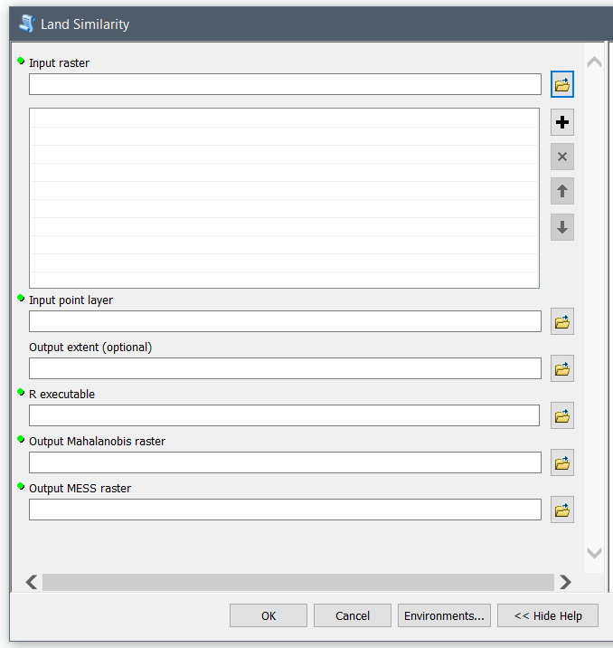
Below is how to the toolbox looks like.
 It brings the following error message.
Submitted.
Executing...
Executing (Land Similarity): LandSimilarity E:\arcgisserver\directories\arcgissystem\arcgisuploads\services\targeting_tools\LandSimilarity.GPServer\if7853d60-27e6-40b8-a101-283848da59ea\uganda_rainfall_2011_Jan_to_Dec.tif "Feature Set" "Feature Set" "C:\Program Files\R\R-3.4.0\bin\R.exe" D:\CIAT\data\man D:\CIAT\data\mess
Start Time: Sat Dec 09 07:22:17 2017
Running script LandSimilarity...
ERROR: [Error 3] The system cannot find the path specified: u'D:/'
Completed script LandSimilarity...
Succeeded at Sat Dec 09 07:22:20 2017 (Elapsed Time: 2.79 seconds)
Succeeded at Sat Dec 09 07:22:20 2017 (Elapsed Time: 3.35 seconds)
Invalid return value: D:\CIAT\data\man
Failed.
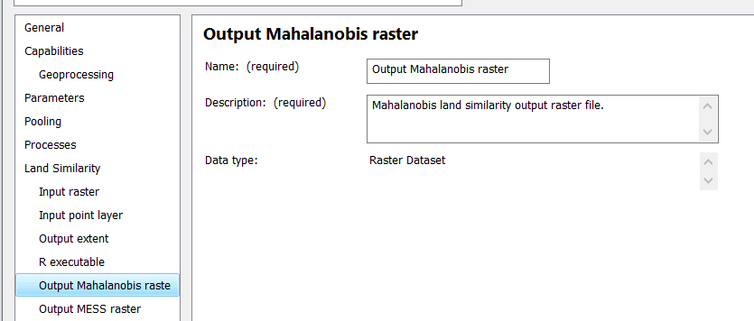
However, the Output Parameter is properly detected as shown below.
Please note that there are two Raster Layer Outputs and a Map Services is created for the service.

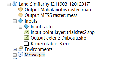
The toolbox runs fine in Desktop as shown in the result below.
 How could I make it publish the Raster Layer and remove the Desktop Output Parameters.
Which are:
D:\CIAT\data\man D:\CIAT\data\mess
