I'd like to use my Garmin 20 to go biking. Since I do not want to buy one of microSD card from garmin, I'd like to build one myself.
For this I went to:
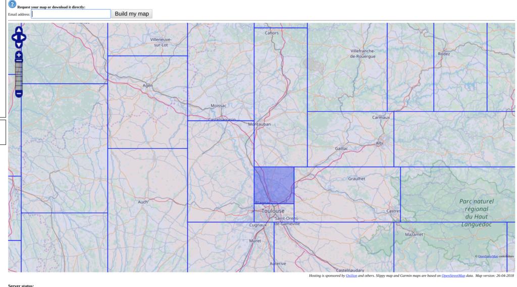
Selected:
- "Routable Bicycle (Openfietsmap Lite)"
and
- "Enable manual tile selection: "
And then simply selected region north of Toulouse, France:
This seems to be the direct link:
After a couple of minutes, I received an email containing a direct link to the GMAPSUPP.IMG. If I extract this file and copy it:
$ unzip openfietsmap_lite_gmapsupp.zip
$ cp gmapsupp.img /media/malat/GARMIN/GARMIN/GMAPSUPP.IMG
Then everything works as expected, except one tiny detail: accented characters. My Garmin 20 does not display some city names properly.
Some cities contains odd characters for example:
- Bruguières is stored as "BRUGUI?RES"
- Saint-Geniès-Bellevue is stored as "SAINT-GENI.S-BELLEVUE"
- Villeneuve-lès-Bouloc is stored as "VILLENEUVE-L.S-BOULOC"
Is there a way to export/re-create this particular map using proper Latin1 encoding to fix all the invalid encodings ?
Update: I can fix the binary file directly using hexedit, for example I can generate the correct name for "Bruguières" using:
$ file input
input: UTF-8 Unicode text
$ cat input
BRUGUIÈRES
$ iconv -o output -f utf8 -t latin1 input
$ file output
output: ISO-8859 text
Then I simply replace the original '3F' into 'C8' and then everything works as expected. While this is obviously not a proper solution (I would need to fix hundreds of binary strings) this demonstrate that a proper conversion is possible.
It seems the original 'img' file:
Already contains the invalid character encoding. So I need to generate the img file myself.

